DALLAS — Christmas is around the corner! Here's what we're expecting weather-wise over the next week, and then through the end of the year:
En español: El Reporte del Tiempo en Dallas-Fort Worth: La Navidad está cerca. ¿Cómo se ve el clima?
Quick facts:
- Several rounds of rain between now and Christmas Eve
- Above normal temps continue through Christmas Day
- Cooler and drier to end the year
This week and weekend
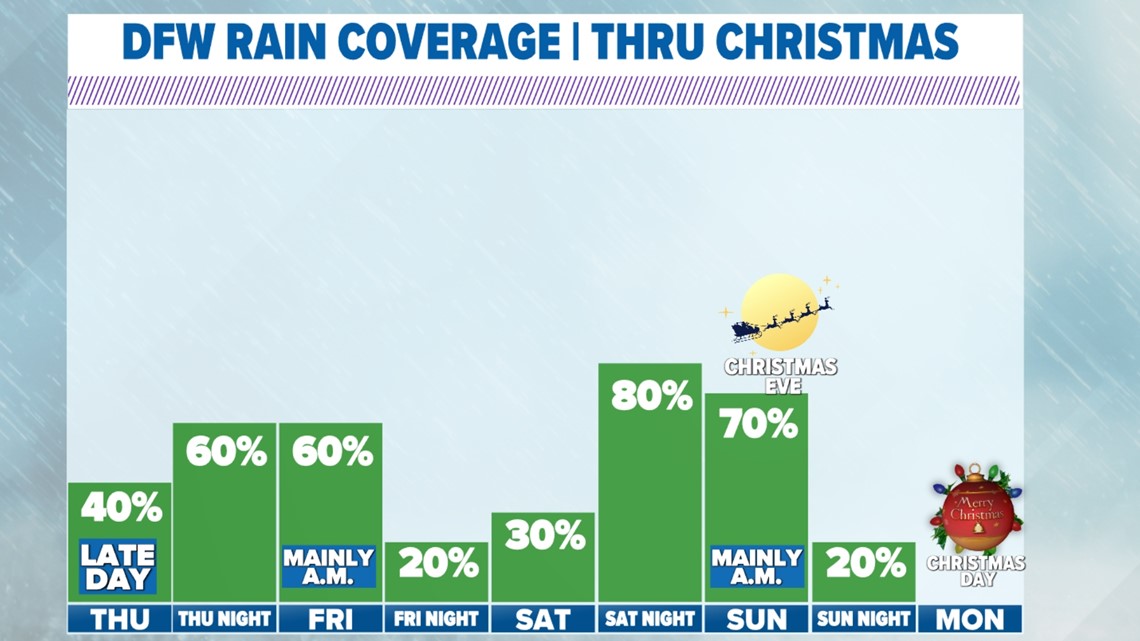
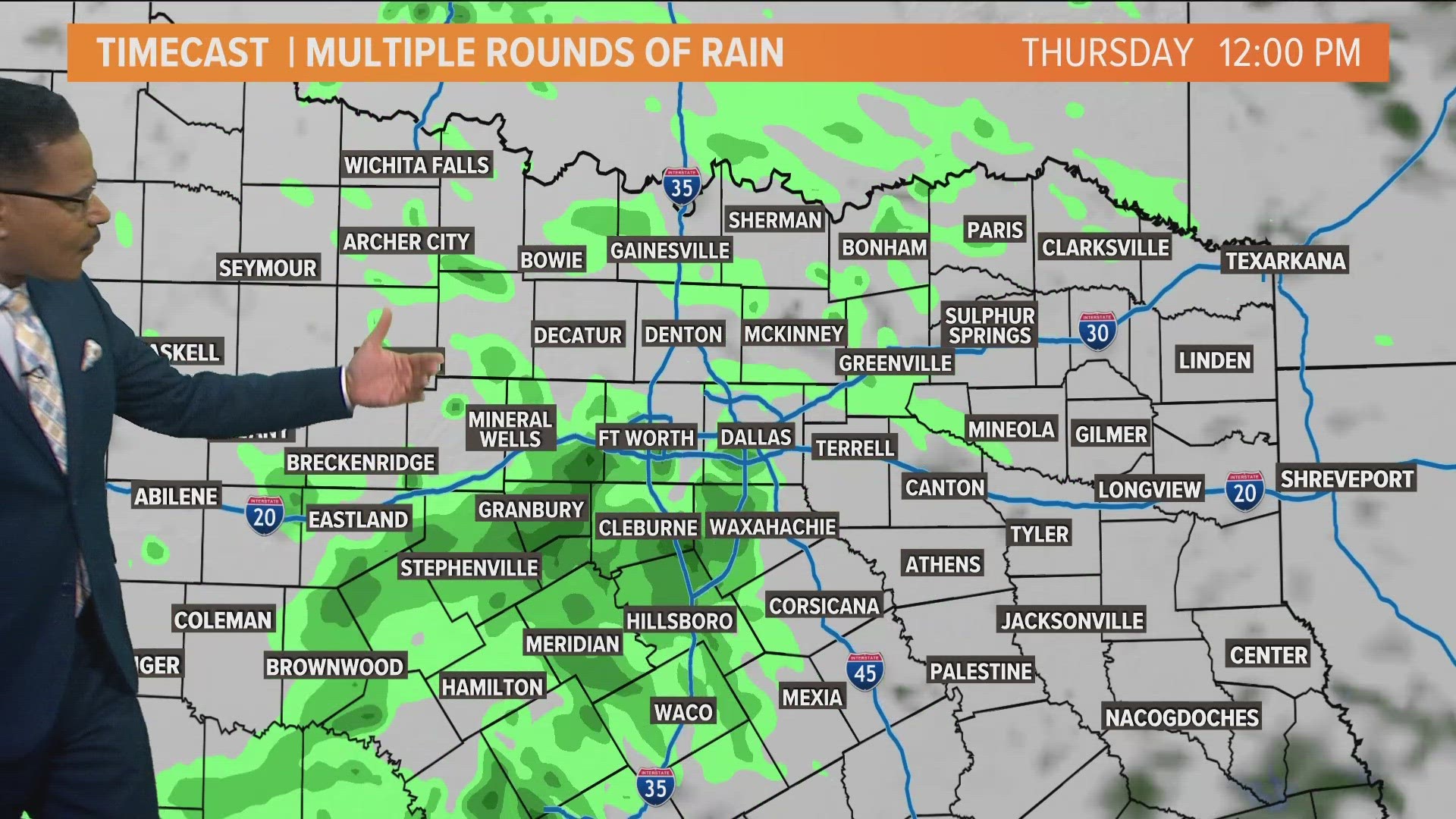
Thursday will be a cloudy day with some showers moving into North Texas from the west. Showers will increase in coverage Thursday afternoon with rain sticking around into Friday morning. Especially for areas east of DFW.
Friday will start off with rain from DFW to the east, but rain will move out with a mainly dry afternoon and evening in store.
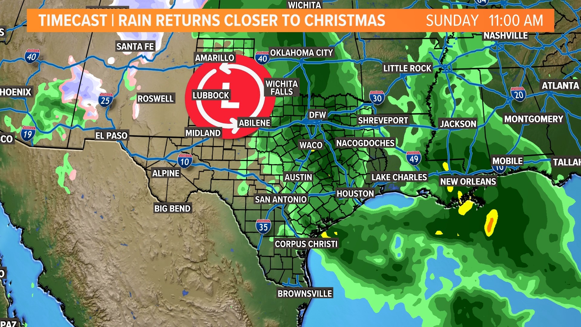
Saturday will start off dry, but clouds will be around during the day and some late day scattered showers or storms are possible. Saturday night into Sunday will feature a good chance for showers and storms as a round of rain moves across North Texas. The severe threat looks low at this point, but we'll keep an eye on it as we get closer.
Sunday will start off with rain from DFW to the east. Rain and storms will shift east through the day with most of North Texas dry by Sunday evening into Sunday night. Behind the rain, temps may be the warmest of the Christmas Weekend with highs around 70°


Christmas forecast
This year will NOT be a White Christmas.
Christmas Eve will start off with some rain in the morning before looking drier during the afternoon into evening.
Christmas Day looks mild, dry, and breezy with highs around 60°. The normal high for Christmas Day is 56°, so that's not too far above normal.


Rainfall timeline
14-day forecast
After Christmas and rounding out the year, temps look back closer to normal. Highs in the 50s and mornings in the 30s. The pattern looks drier to end the year with no rain in the forecast after Christmas.


