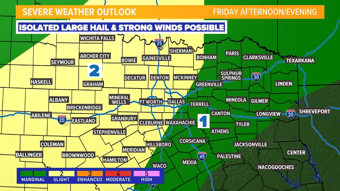
DALLAS — The western half of North Texas was expected to see some severe weather.
Multiple counties, such as Montague, Palo Pinto and Wise, saw tornado warnings through the evening.
Friday
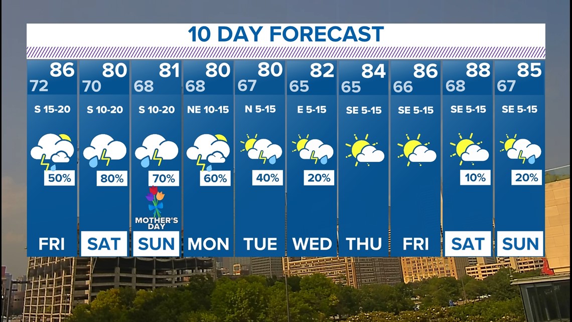
Most of Friday will be dry, warm and humid. During the afternoon, a cluster of showers and thunderstorms will move into North Texas. The threat of severe weather will be low, but a few scattered storms could contain large hail and strong winds. The higher threat looks to be west of DFW. A broken line of showers and storms approaches the I-35 corridor counties during the evening.

Mother's Day Weekend
Rain coverage looks like it will increase even more for Mother's Day Weekend.
It may not rain every second in every square inch of North Texas over the weekend, but rounds of rain are likely. Especially across western North Texas.
Keep monitoring the forecast if you have plans and an indoor alternative to those plans is a good idea.

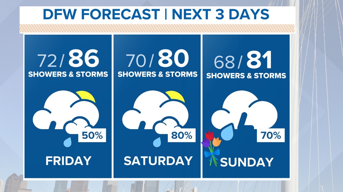
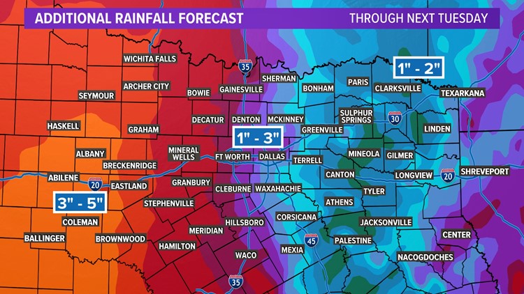
We have a lot of moisture to work with, so rainfall totals through early next week look to be around 1 to 3 inches across the area with higher totals possible for western North Texas. Eastern areas will still see rain, but totals may not be as high. Higher totals in western North Texas is definitely needed due to an ongoing drought.


Next 10 days
This active pattern may start to come to an end by early next week as temps will return back to normal or a bit above normal.