DALLAS — On average October sees the biggest drop in normal high temperatures and it is the 2nd wettest month of the year. Will the second half of the month reflect that?
Let's dive into that with a look at what's to come weather-wise these next few days.
Quick look ahead:
- Near record warmth possible this week
- 90s could return this week
- Staying dry with low humidity
Warmer temps return soon
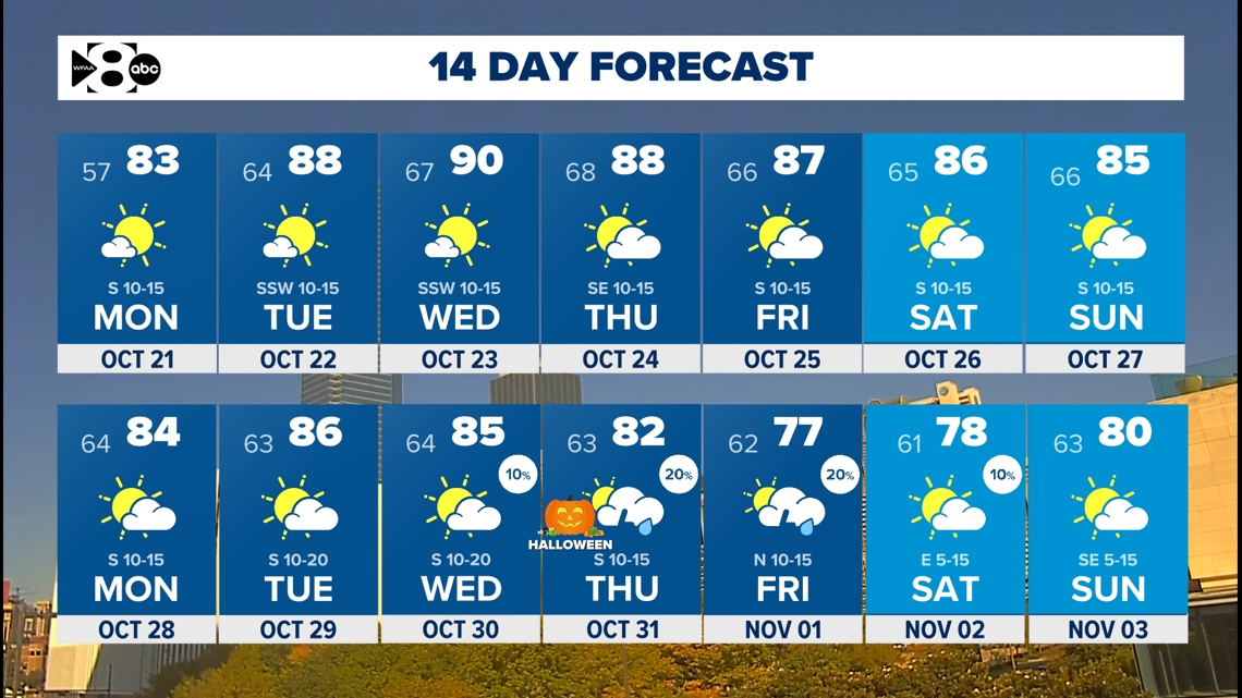
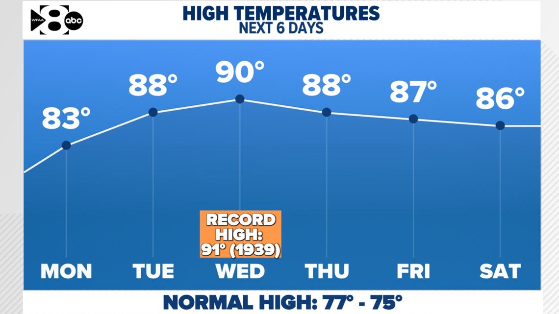
Unfortunately, our seasonable weather will end this week as temps climb back to well above normal. Highs peak in the upper 80s to touching 90°, which is around 10° to 15° above normal for this point in the fall.

Any rain chances?
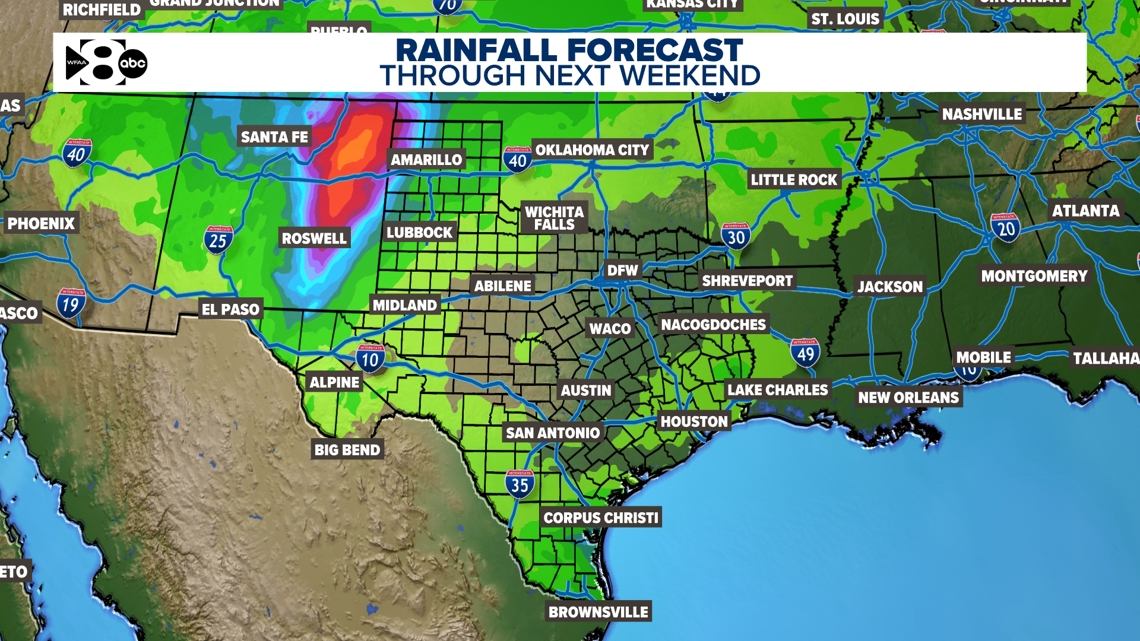
Not anytime soon.
Rain chances stay slim to none through at least next weekend. MAYBE a few showers try and get close to the Red River late this week into next weekend, but chances are very low at this point.

We need the rain!
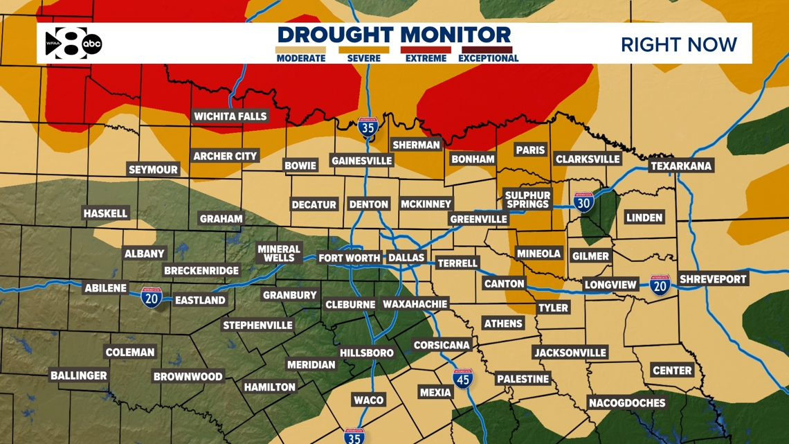
The latest drought monitor in North Texas shows we're in a fairly widespread moderate to severe drought. All was going so well until the summer! And it's only gotten worse since June. The good news? On average, North Texas sees 4.37 inches of rain in October, making it one of the year's wettest months. The bad news? Most of the month looks dry.
With the increasing drought concern, there is an elevated grassfire danger for the foreseeable future.

14-day forecast