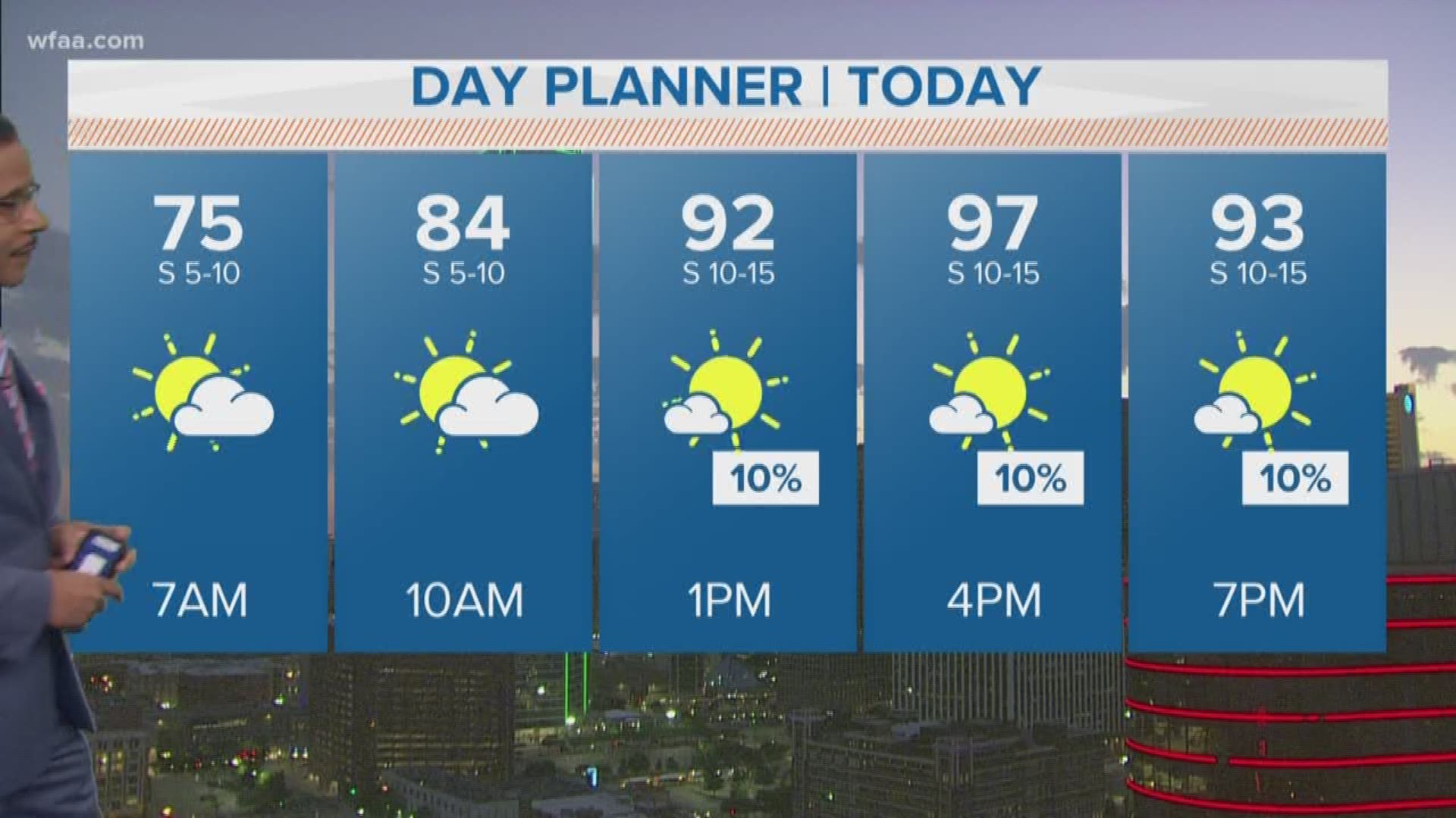
6 a.m. UPDATE: Storms moved east overnight, but the heat stays. Don't lose your cool. It will be heating up in a hurry!
A Heat Advisory extended until 8 p.m. Thursday for Dallas, Tarrant, Rockwall, Parker, Johnson, Kaufman Counties. The heat index could approach 105 degrees in some areas later on, so make sure you stay hydrated.
12 a.m. UPDATE: The Tornado Watch has expired for North Texas. Storms are still likely mainly for eastern North Texas over the next several hours. A few storms could be severe with wind and hail. There is also a threat of flash flooding with any heavy rain. DFW area could see a few lingering showers or storms, but storms will mainly be confined to areas east of the DFW Metroplex.
11:30 p.m. UPDATE: Scattered showers and storms are still ongoing across parts of the metroplex at this late-night hour. Stronger storms have stayed mainly east of DFW with wind, hail and heavy rain the main concerns. All activity should continue to push southeast, eventually clearing out overnight.
10:30 p.m. UPDATE: A broken line of showers and storms have fired up in the heart of DFW. Though these storms are not severe at this time, we will continue to keep an eye on them. Either way, you may get some heavy rain, lightning, and thunder as you're headed to bed.
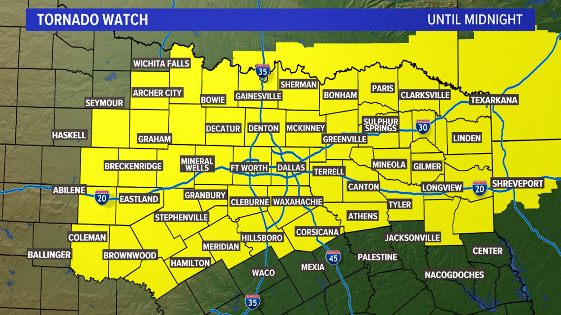
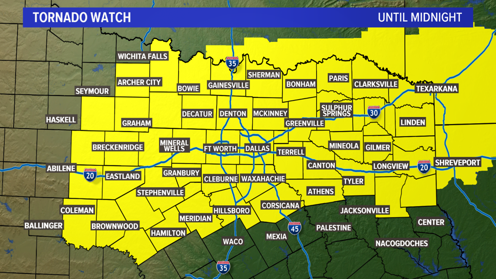
9:30 p.m. UPDATE: The Tornado Watch has been trimmed, no longer including much of the area northwest of DFW. However, the rest of North Texas and DFW still remains under the Tornado Watch until midnight.
Storms have initiated along the boundary, with a warned storm in Collin County due to wind and quarter size hail.
8:30 p.m. UPDATE: A westward-moving boundary may collide with our weak front. This could lead to the initiation of showers and storms. The area to watch would be the western edge of the metroplex. Again, much of the day has been quiet for most...the severe threat is not over. Our Tornado Watch continues until midnight.
7:17 p.m. UPDATE: Storms will continue across northeast Texas. DFW area storms are uncertain right now because a "cap" is still in place. We're watching to see if activity from the west will move into N. TX. If DFW sees storms, timing looks like the late evening hours.
According to the Oncor Outage Map, 1,539 customers are without power and the anticipated fix will be by Thursday at 12:30 a.m.
5 P.M UPDATE:
Showers and storms have fired up mainly northeast of DFW. The storm that originated in Collin County continues to strengthen as it moves into Fannin and Hunt Counties. Tennis ball size (2.50") hail reported in Farmersville.
The rest of the metroplex is quiet right now, but we expect more storms to erupt as the evening moves forward.
4 P.M. UPDATE:
A Tornado Watch has been issued until midnight for most of North Texas including the DFW area. Our main concern continues to be damaging winds (60-70+ mph) and very large hail (up to 2in). However, there is a risk of tornadoes before the storms form into a line or cluster. Even then, the tornado threat is not zero as brief, spin-up tornadoes within the line are possible.
Timing for storms:
Now - 7pm: Mainly north/northeast of the DFW area. Storms develop and gain in strength.
7pm - 10pm: Most likely time-frame for DFW to see storms. Storms will either develop overhead or move in. Severe storms are possible.
10pm - 2am: Storms will move out of the area the later in the night you get. Before midnight, strong to severe storms will still be possible for mainly eastern and southern North Texas. After midnight, most of the area will be dry.


North Texas will be very warm and humid most of the afternoon, but our main attention turns to storm chances later today and into this evening.
Storms will be possible in most of North Texas, but not everyone will see severe storms or severe weather. However, everyone should be prepared for the potential of severe storms.
Looks like storms will start to form at about 5 p.m. lasting into the late evening hours.
Any storms that form have the potential of becoming severe. Primary threats will be damaging winds (60-70+ mph) and large hail (possibly up to 2in). The tornado threat is low, but not zero.
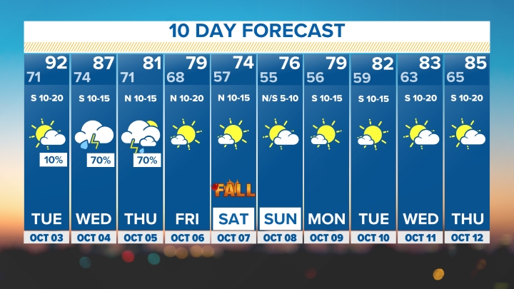
Storms will shift east and move out of the area late Wednesday and early Thursday morning.
The Dallas area will stay hot, humid and dry through Friday.
Be sure to download the WFAA app to check radars for where you live


