DALLAS — Meteorological fall has arrived, but it doesn't feel like it in North Texas!
Quick facts
- Record heat is over
- Much cooler this week
- Rain chances are the best in a long time
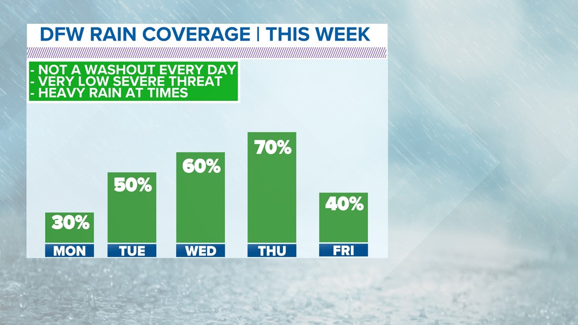
This Week's Rain Chances
The big takeaways with the rain chances this week: best chances in a while, not a widespread rain every single day, the 1"-2" forecast is the total for the whole week.

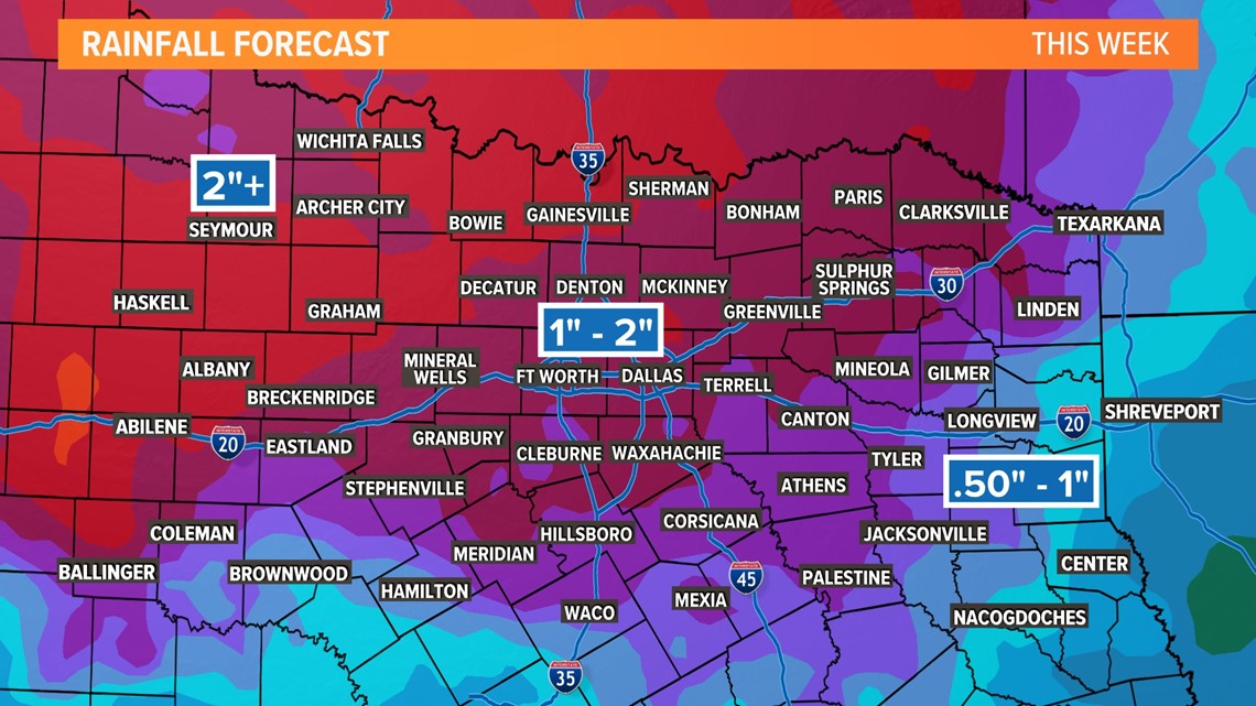
Between Monday and this upcoming Friday, around 1-2" of rain looks possible for most of the area. Some higher totals are possible for western North Texas with lower totals for eastern areas of North Texas.
The severe threat this week doesn't look to be completely zero, but does look to be very. Can't rule out some gusty winds or hail. Some heavy rain may be possible at times under t-storms, but flooding issues look unlikely at this point.

This Week's Temperatures
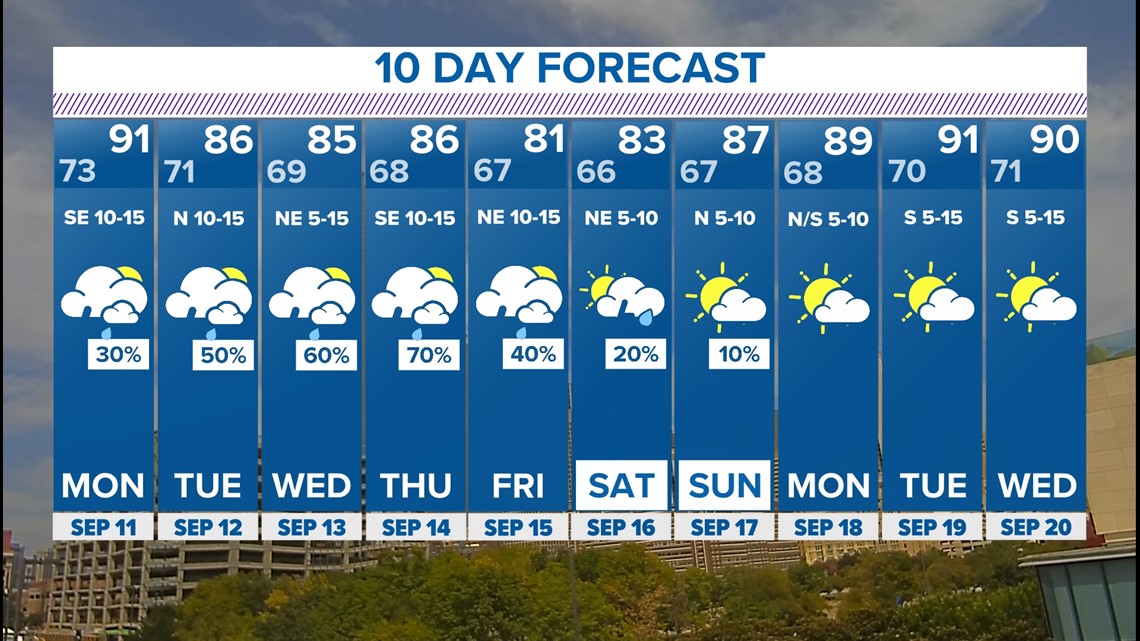
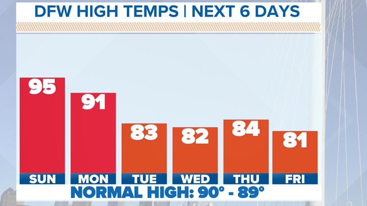
FINALLY, some respectable temperatures around here. Highs will actually be below normal for most of the next 10 days. Highs will even be in the 80s this week!

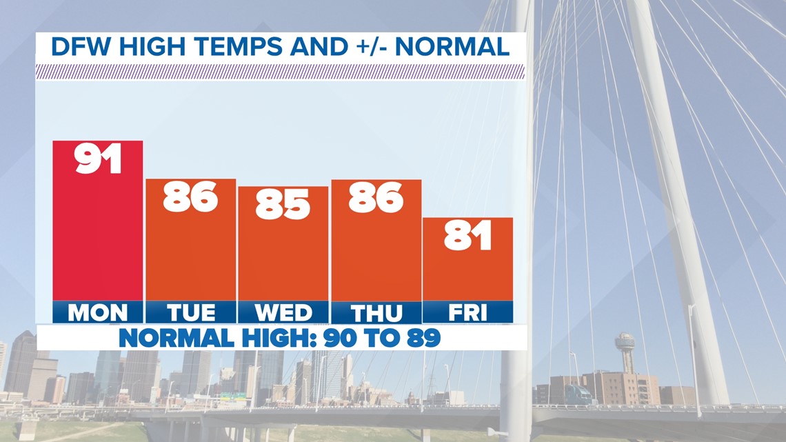
Are we finally done with the triple digits??
It's very possible!
The latest 100° day ever recorded at DFW is Oct 3, 1951 (106°F). And it's only ever been in the triple digits three times on record at DFW in October. Looking through the 18th of September, we do NOT see triple digits, and after that it becomes very uncommon.
With that being said, the odds are fairly good that we are done with 100°+ temps, but this summer has been intense.
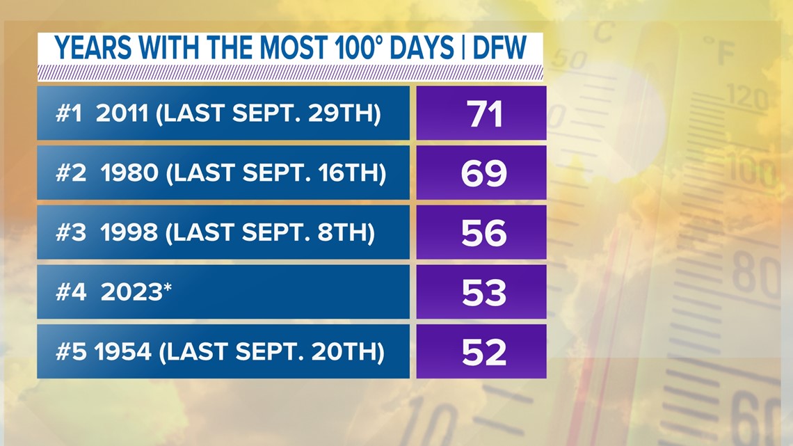
If we look back to other summers with similar intensity, two of the five have had a triple-digit day into the last week or so of September.

10-day forecast

