DALLAS — North Texas sees changes in the weather this week with showers and storms returning on Thursday.
Here's a look at what you can expect:
Quick Facts:
- Mild weather continues
- Rain and storms through this evening
- Drier, warm weekend ahead
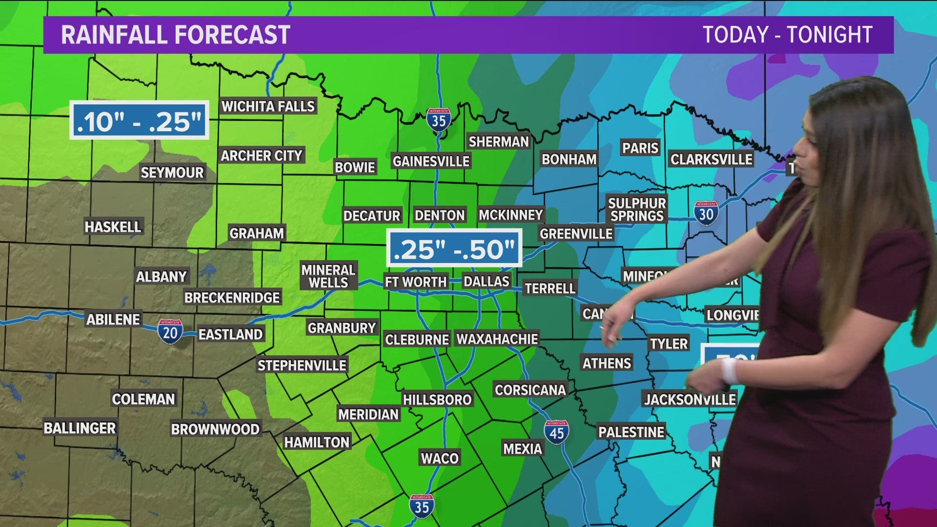
Rain returned Thursday
The day has started with scattered showers from DFW to the east. On-and-off showers and storms will continue through the afternoon.
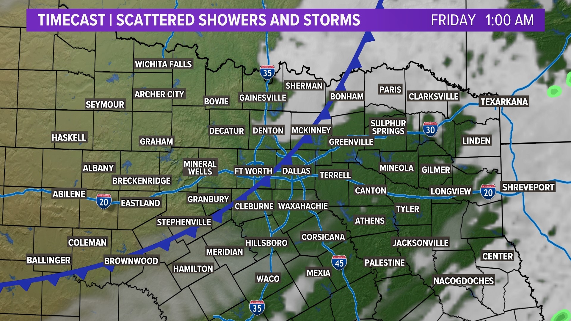
By late evening, most rain will be confined to eastern North Texas with rain moving out of North Texas during the evening into nighttime hours.
DFW: An isolated t-storm or two is possible late afternoon into the evening as a front approaches.
TIMELINE:
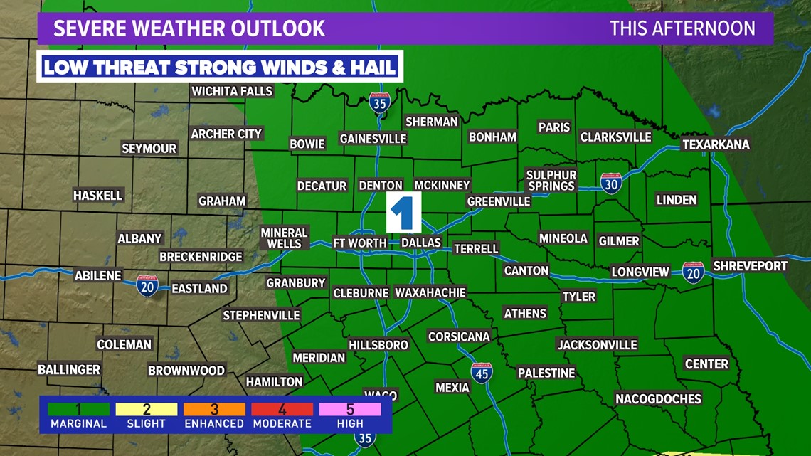
Severe storm threat
The severe weather threat for North Texas looks low at this time, but not completely zero. A few storms could have some hail and strong wind gusts especially east of DFW.
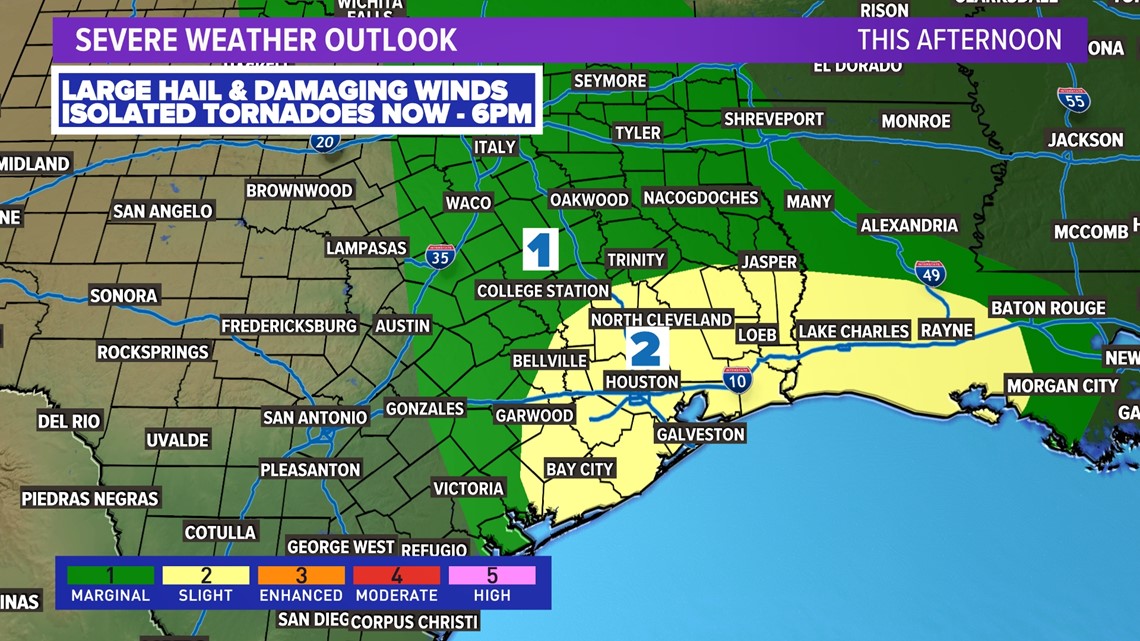
The higher threat of severe weather is in Southeast Texas. That's where hail and strong winds will be more common along with the threat of a few tornadoes as well.


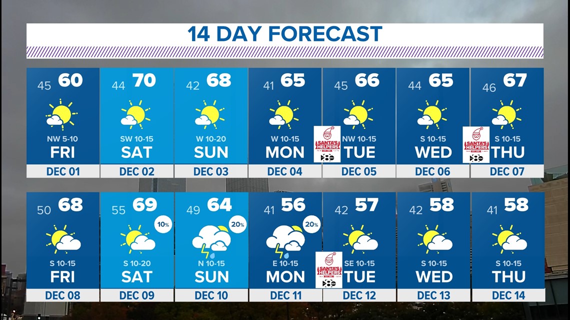
Friday and this weekend
Rain moves out with a dry Friday and dry weekend in store. Friday will be a little cooler behind a front, but temps warm quickly this weekend. Highs will be near 70 on Saturday and in the upper 60s on Sunday. Next week will be trending mild and dry.