DALLAS — Be sure to download the WFAA app to track the latest forecast and get alerts from our team.
Quick facts:
- Spring-like temps continue
- Rainy tonight, and possibly into Friday
- Low severe threat, but not completely zero
Versión en Español: Un comienzo de semana fresco con lluvias que regresan antes del fin de semana
Live Radar
Tonight
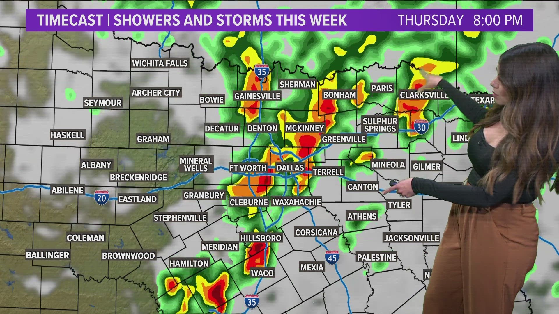
Showers and storms will increase in coverage, especially across western North Texas. That round of showers and storms will then move east across most of North Texas during the evening into nighttime hours.
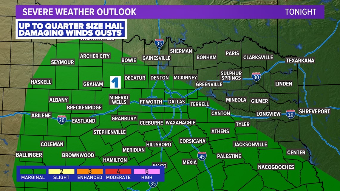
While the severe threat continues to be low, this is the time when some storms may become severe mainly in western and southern North Texas. Threats will be hail up to quarter size and some strong wind gusts.
Any storms are guaranteed to have lightning and heavy rain, but a few could become severe.
Rain will linger from DFW to the east during the late night hours Thursday, but any severe storms will end with just rain sticking around for some heading into Friday morning.


Timeline into Friday
Lingering showers (but no severe weather) will be around first thing Friday from DFW to the east. Those showers will shift east during the morning hours with all of North Texas dry by the afternoon. Even some sunshine will break out from west to east during the day as well.
Rain Totals
Another soaker heading to the area!
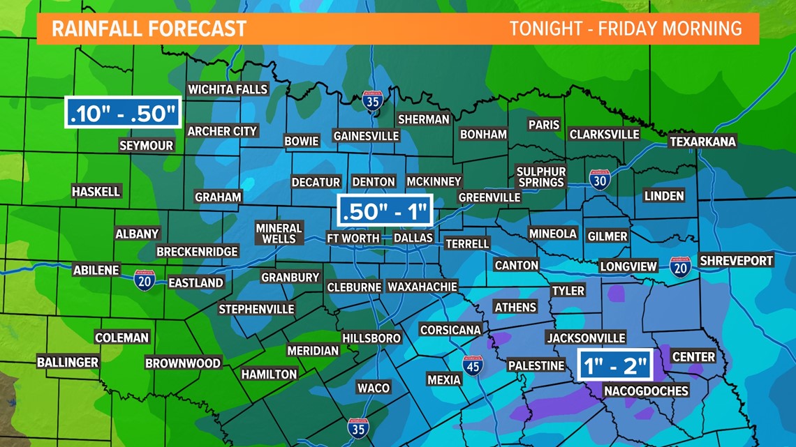
Totals of around .50in to 1in are possible for most with higher amounts to the east and lower amounts to the west.


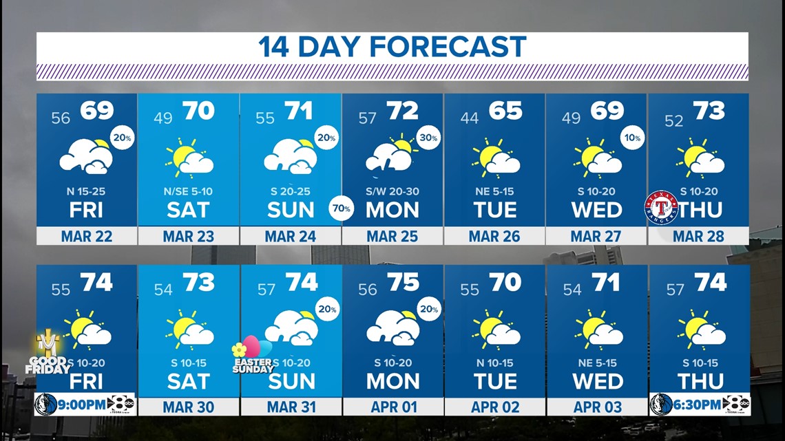
14-day outlook


