DALLAS — Be sure to download the WFAA app to track the latest forecast and get alerts from our team.
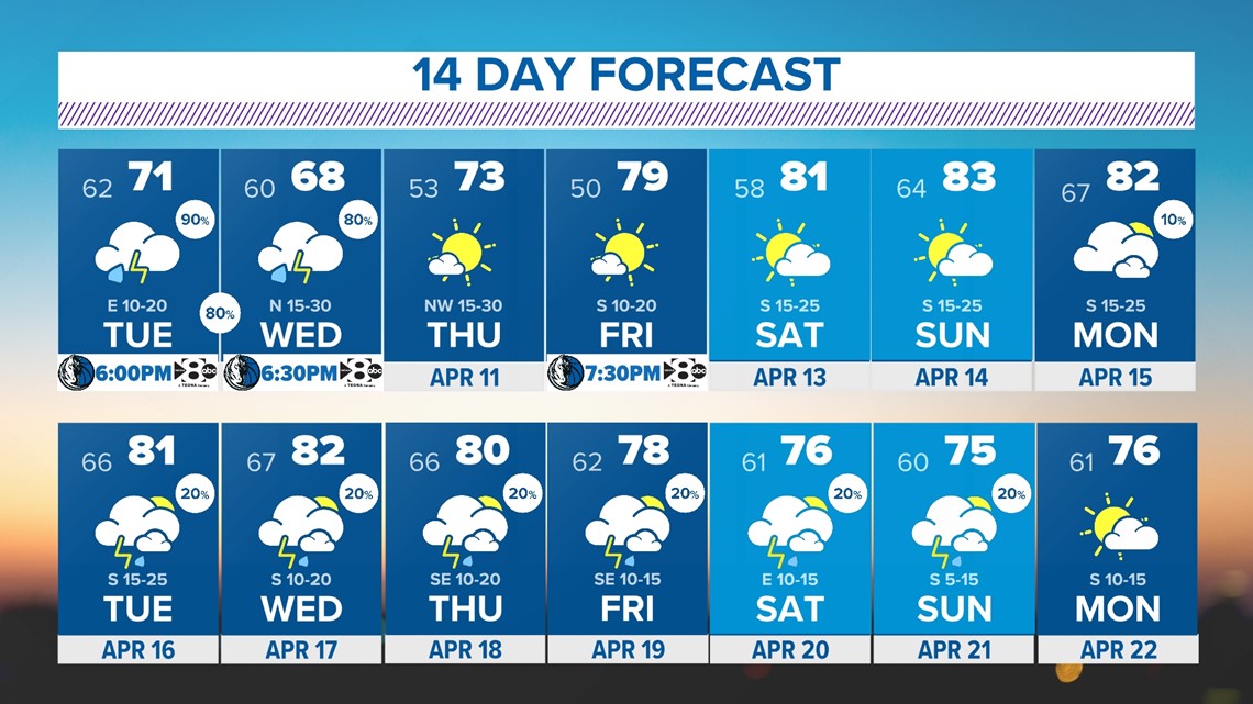
Here's the latest forecast for North Texas this week:
Quick facts:
- More storms and possible severe weather Tuesday and possibly Wednesday
- Widespread rainfall and potential for flooding in some areas over the next couple of days
Live radar:
Storms and severe weather chances
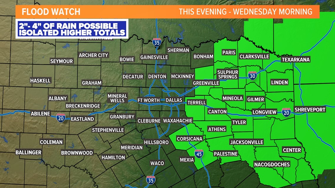
Multiple rounds of storms will move through North Texas this week. Some of those rounds will carry a threat for severe storms as well. Minor flooding could also occur in places that see the most rain through the week (mainly eastern North Texas).
Tuesday
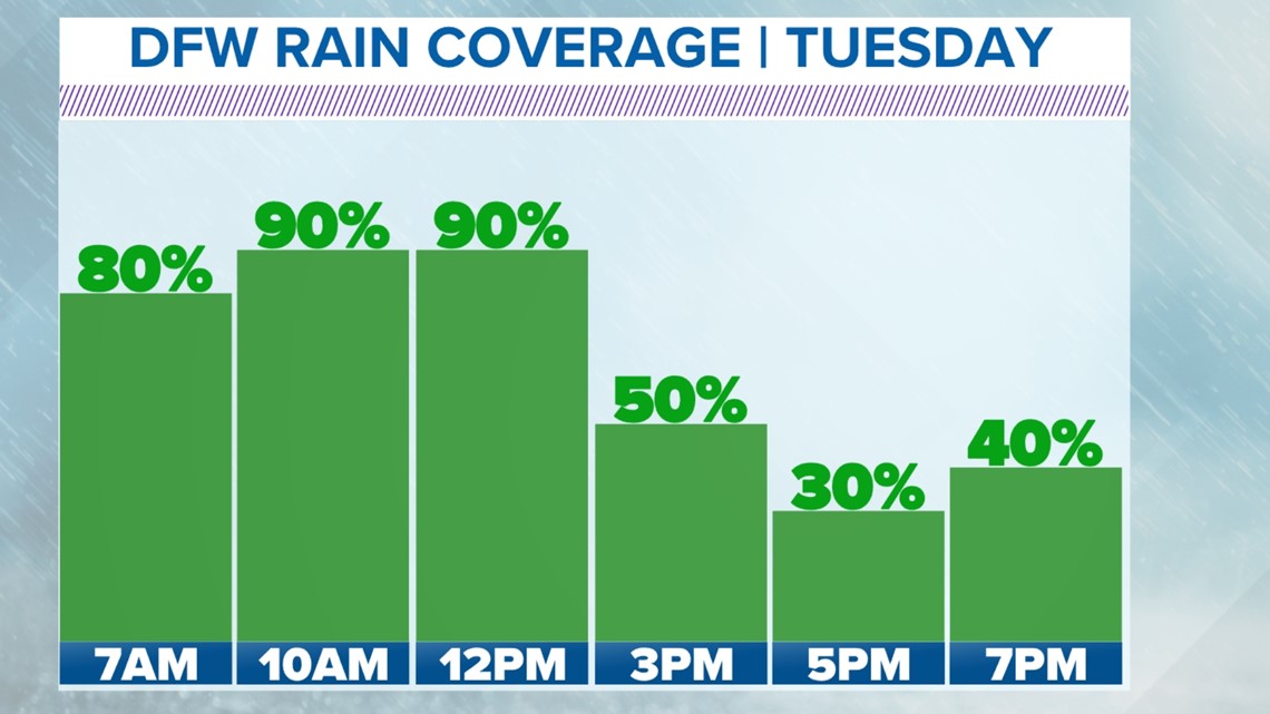
Rain and storms will likely still be ongoing in parts of North Texas to start the day, but the severe threat looks low during that time.
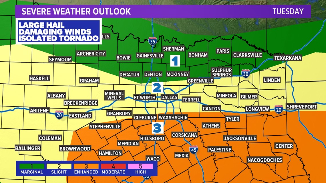
Storms and the threat for severe weather will ramp up again late morning through early afternoon mainly from immediate DFW to the south. Main threats would be large hail and damaging winds, but the tornado threat will not be zero either.
While some showers and storms are possible through the remainder of the afternoon into the evening hours, the severe threat during that time looks lower.

Wednesday
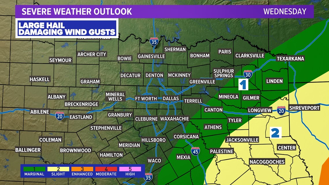
More rounds of storms are possible, but will likely depend on what happens Tuesday into Tuesday night. As of now the threat for severe storms looks to be in East Texas but this forecast will be fine-tuned as we get closer.


Rainfall
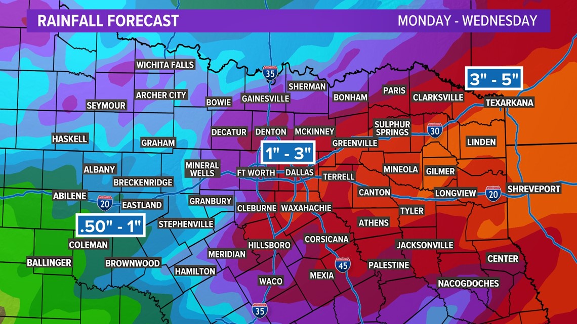
By the time the rain leaves North Texas Wednesday night into Thursday, totals of around 1 inch to 3 inches are likely for most. Higher totals are possible for eastern North Texas into East Texas, which is where some minor flooding may occur with repeated rounds of rain.


14 Day Forecast

