
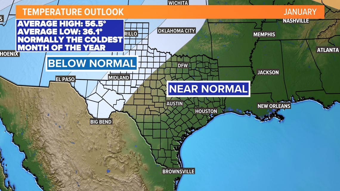
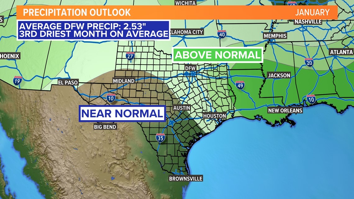
DALLAS — January has arrived! This month is the coldest of the year for DFW, but the third driest on average. This is also the time of the year when North Texans think about the potential winter weather hazards.
Here is what the January outlook looks like so far.
The short answer:
The general pattern hints that North Texas will likely see a wetter-than-normal January with temperatures that are near normal. The average high temperature for the month is 56.5 degrees with a low of 36.1 degrees. The average rainfall is just over two and a half inches.


This does not mean that we can rule out winter weather for the month altogether. It just means that it is not looking cold enough for widespread, impactful winter weather in North Texas as of now.
The longer answer:
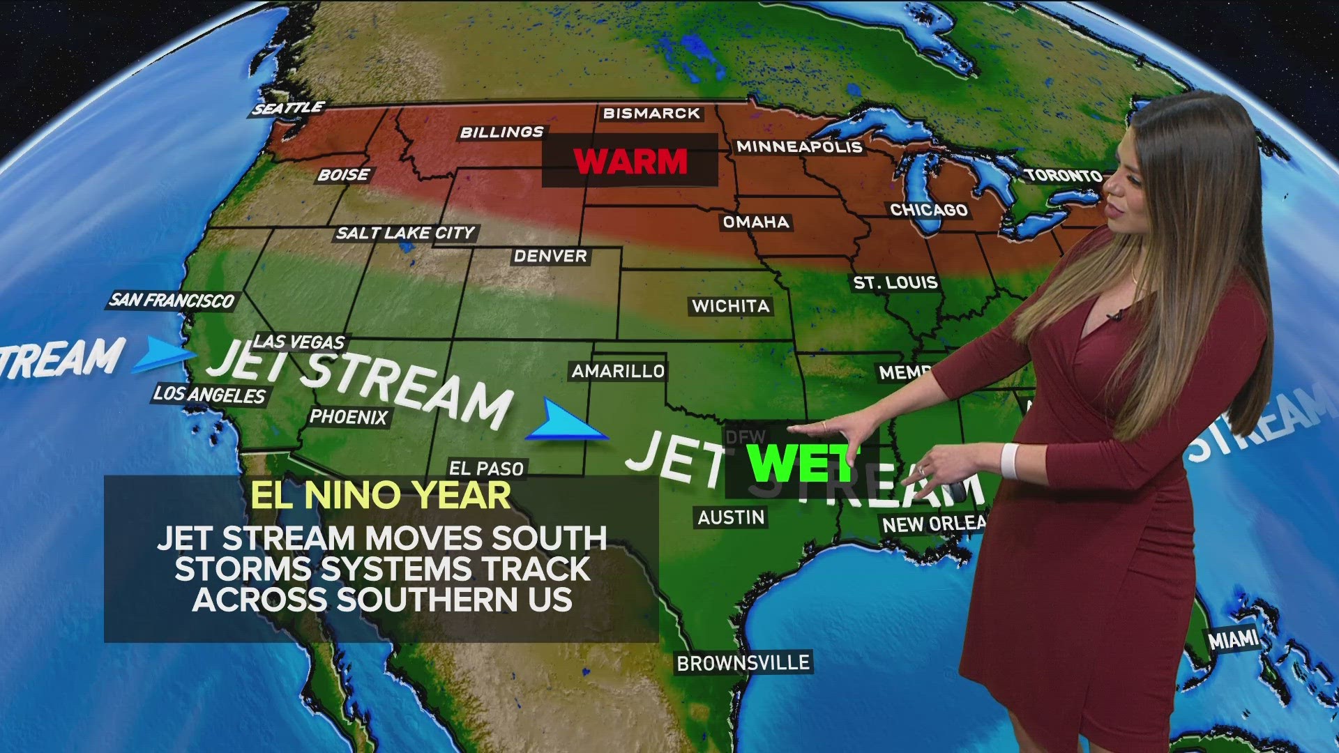
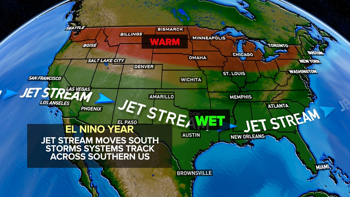
Our winter weather outlooks rely on the water along the equator in the Pacific Ocean. This influences how our jet stream (a fast, narrow current of air flowing from west to east that drives weather) acts during the winter months.
The temperature along the Equatorial Pacific shows us a hint of how strong certain air currents are or are not. The temperature tells us if we are in an El Niño (warming of water along the equatorial Pacific) or La Niña (cooling of water along the equatorial Pacific) or neutral phase. The last three winters were influenced by a La Niña, but a shift was detected in 2023.
This year, an El Niño is in place as we approach the winter months for the first time in four years. Generally, this pattern shifts our jet stream making our winters more active. A more active pattern means a wetter than normal and cooler than normal winter for the south.

Not only do we look at patterns based on El Niño, La Niña, or neutral conditions, but we also look at the strength of each to help determine an outlook for winter.
The top 5 snowiest winters happened during weak to moderate El Niño phases. However, the winters with "average" snowfall have all happened during (all phases) weak El Niño phases, strong El Niño phases, neutral phases, strong La Niña phases, and weak La Niña phases.
The last time we had an El Niño of similar strength was during the winter of 1997-1998. That winter ended up being the third-wettest winter on record with 15.22 inches of rain. No ice was reported with only a trace of snow indicating that temperatures were not cooler than normal. This doesn't mean that will be the case this time around, but looking at patterns helps to give an idea of what we have in store this winter.
As always, the weather is evolving and each week can look different.
Be sure to stick with the WFAA Weather team. We can get through another winter together!