DALLAS — Be sure to download the WFAA app to track the latest forecast and get alerts from our team.
We're entering what is typically the hottest time of the year, but thankfully Mother Nature has other plans!
Quick Notes:
- Unsettled pattern with daily rain chances
- Below normal temps continue
- Typical summer heat will return next week
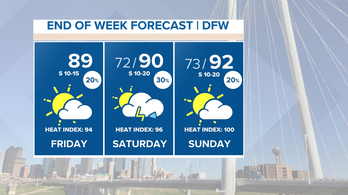
Friday Rain
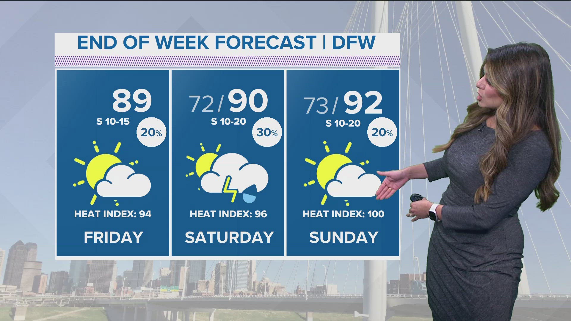
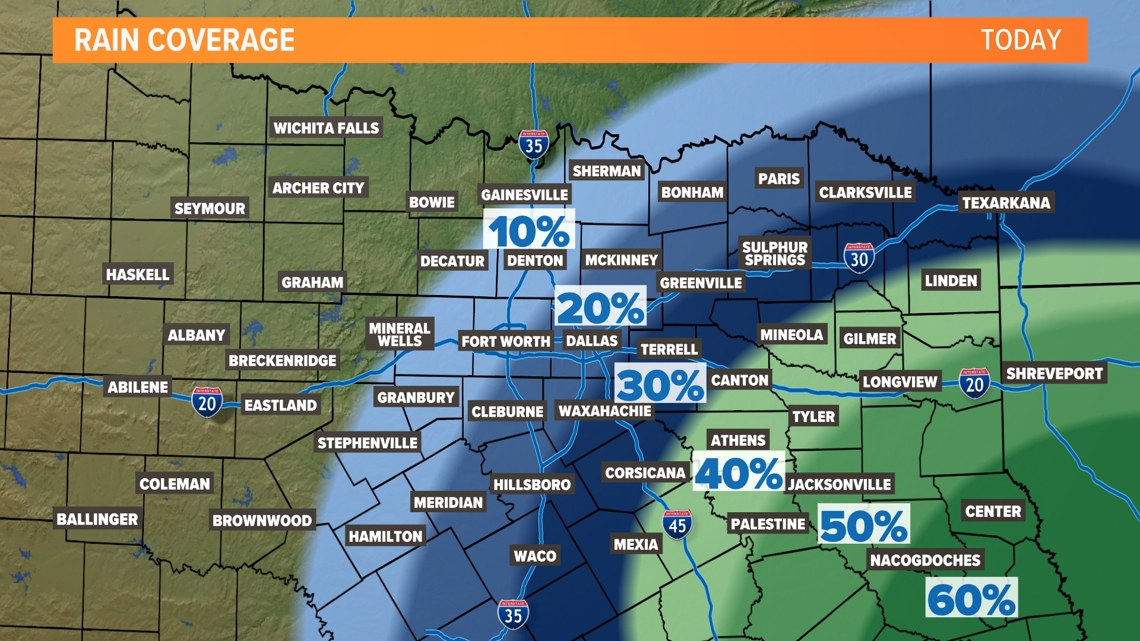
The rain chances on Friday look similar to what we saw Thursday. Isolated to scattered at best and the highest coverage will be well east and south of the metroplex. Most will stay dry.

Below Normal Temperatures... For now...
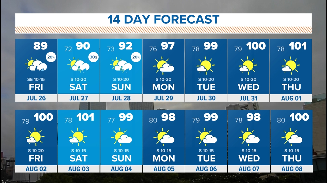
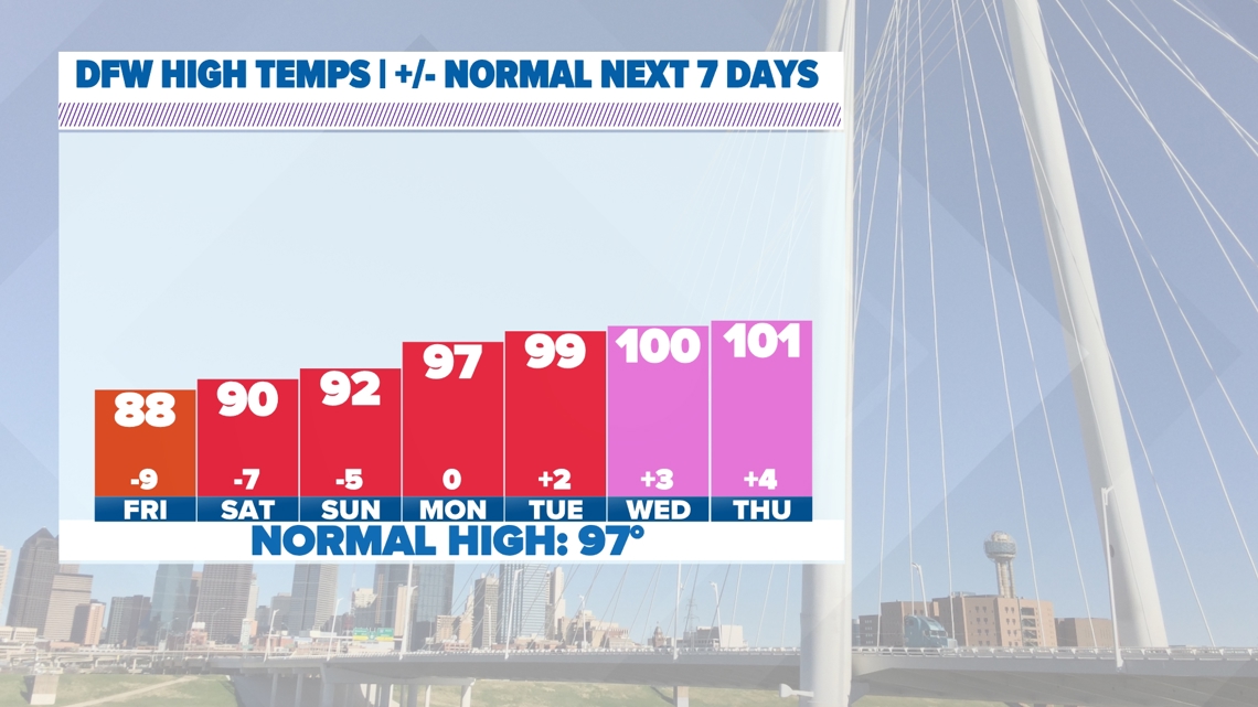
Since July 17th, high temps in DFW have been below normal for this point in the summer with even a handful days only in the 80s! We are officially entering the (normally) hottest days of the year. The normal high by Tuesday climbs to 97° which is the hottest we see in a year, and stays there through August 14th.
Afternoon temps the rest of the week into this weekend won't be cold by any means but they will continue to be below normal mostly in the low 90s.
Enjoy that while it lasts because temps will be back around or even above normal to end July.

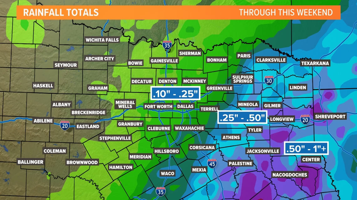
Rain Chances Continue
Just has been the case over the past several days, spotty to scattered showers and storms are possible through this weekend, but not everyone will see rain. Highest coverage looks to be in southern/southeastern North Texas with lower coverage for northern/northwestern areas.

By the end of the weekend, highest totals will be in eastern and southeastern North Texas where a higher coverage of rain is likely. For the DFW area and most of North Texas, totals will come from if you happen to find yourself under a shower or storm. So not everyone will see those amounts through the weekend.

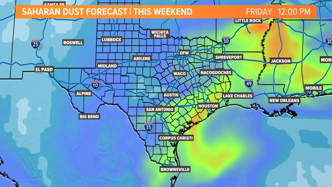
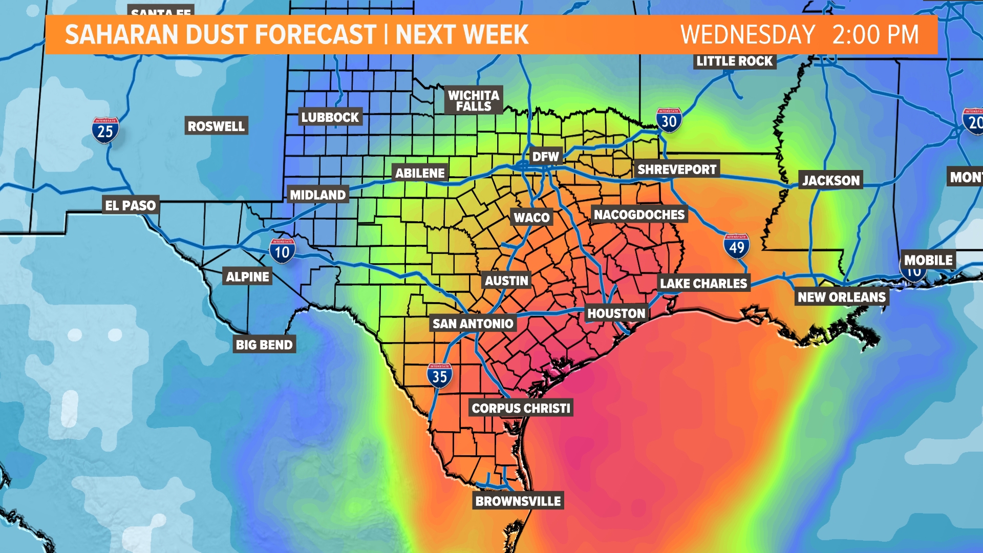
Saharan Dust?
Saharan dust returns this weekend. It is very typical this time of the year. Strong storms over the Saharan Desert haul dust into the atmosphere and that dust gets picked up by the trade winds. Those winds carry dust across the Atlantic and sometimes it makes it into Texas! A couple of rounds are expected in the next week. A small, mild plume looks to arrive Friday before it thins out over the weekend. A bigger, more dense plume that is currently over the Caribbean arrives late Tuesday into Wednesday.

14 Day Forecast