DALLAS — Be sure to download the WFAA app to track the latest forecast and get alerts from our team.
Versión en Español: Es posible que se produzcan tormentas este fin de semana
Quick facts:
- Lingering flooding issues possible Sunday morning
- Drier weather Sunday afternoon and evening
- More storms this week with a severe threat
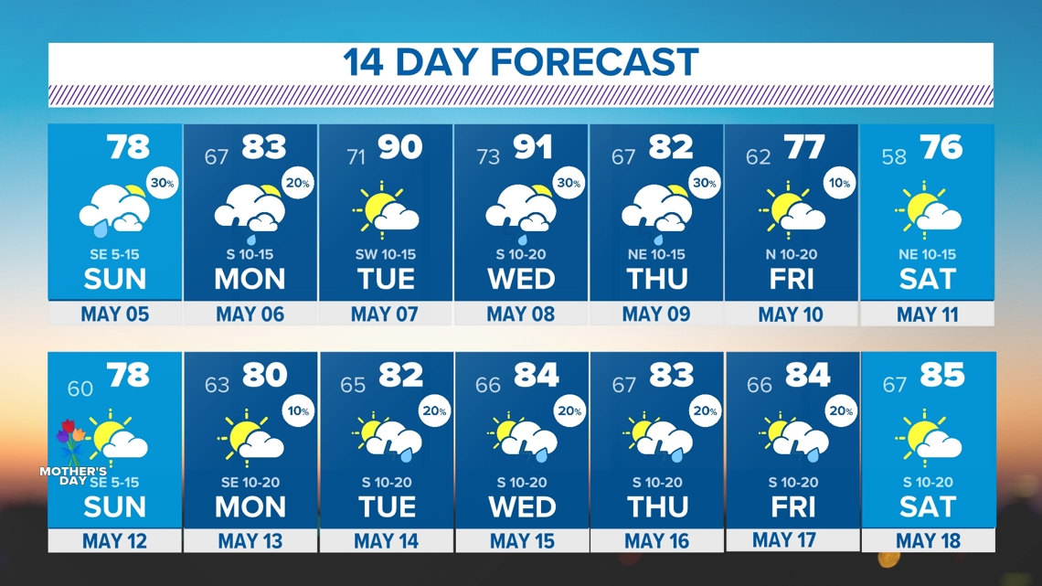
- 90s make a return
Live Radar:
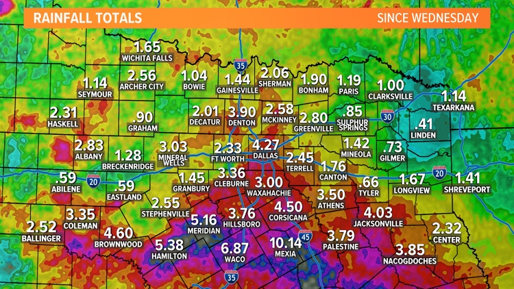
Rainfall totals
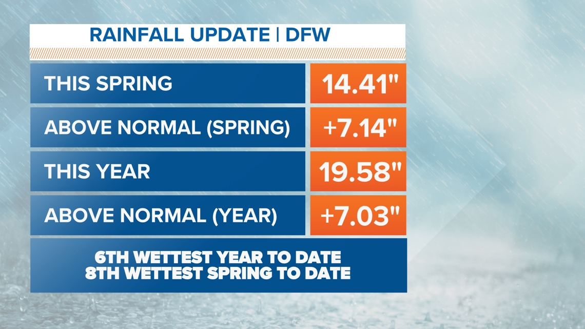
Saturday night into Sunday was a soaker and the last few days have been quite wet as well in what has been a very wet spring in North Texas.
Highest totals have been across southern North Texas into Central Texas where flooding issues have been most prevalent.
This spring and this year so far rank in the Top 10 for wettest on record.

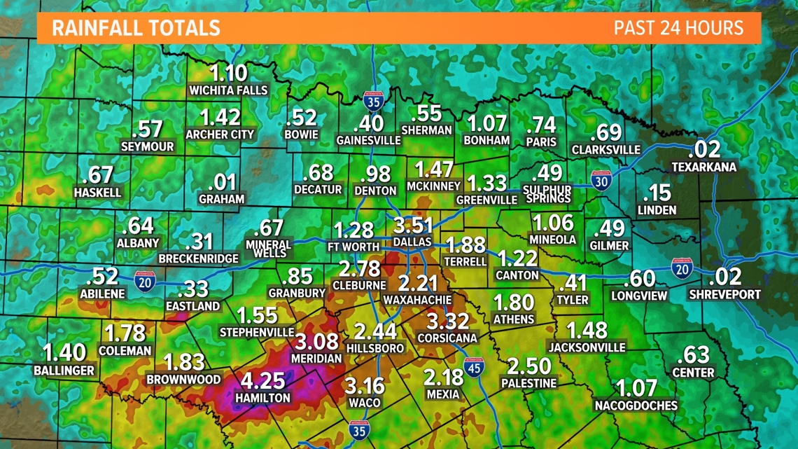


Sunday
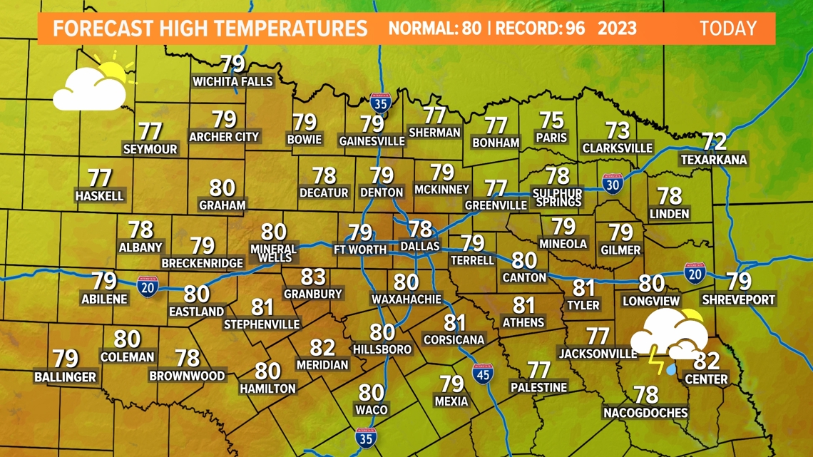
The widespread rain has left North Texas. The rest of Sunday will be mostly rain-free, but can't rule out some spotty showers during the day. Some isolated showers are possible the rest of the day mainly during the afternoon into evening but most North Texans will stay dry.
Otherwise it will be a warm and muggy day with highs in the upper 70s to low 80s. There could even be some peeks of sun possible during the afternoon.

Monday
Most of the day will be dry. A few passing showers or a rumble of thunder are possible during the day, but most places will be dry. Those showers and storms are not overly concerning.
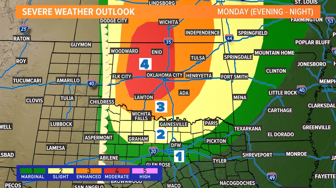
What we'll be watching is a dryline to the west as well as a cap in place. That cap will likely keep thunderstorms from developing or moving into North Texas, but we'll need to watch it closely. If a thunderstorm can form along the dryline and move into northern North Texas, it would be severe with a hail, wind, and tornado threat.
The higher chance for storms and severe weather is mostly in Oklahoma where a higher severe risk is in place.

14-Day Forecast

