DALLAS — Be sure to download the WFAA app to track the latest forecast and get alerts from our team.
Here's a look at the forecast this week!
Quick Facts:
- Warmer than normal temps continue
- Widespread rain returns Friday night
- A few strong storms possible
Dry and warm week
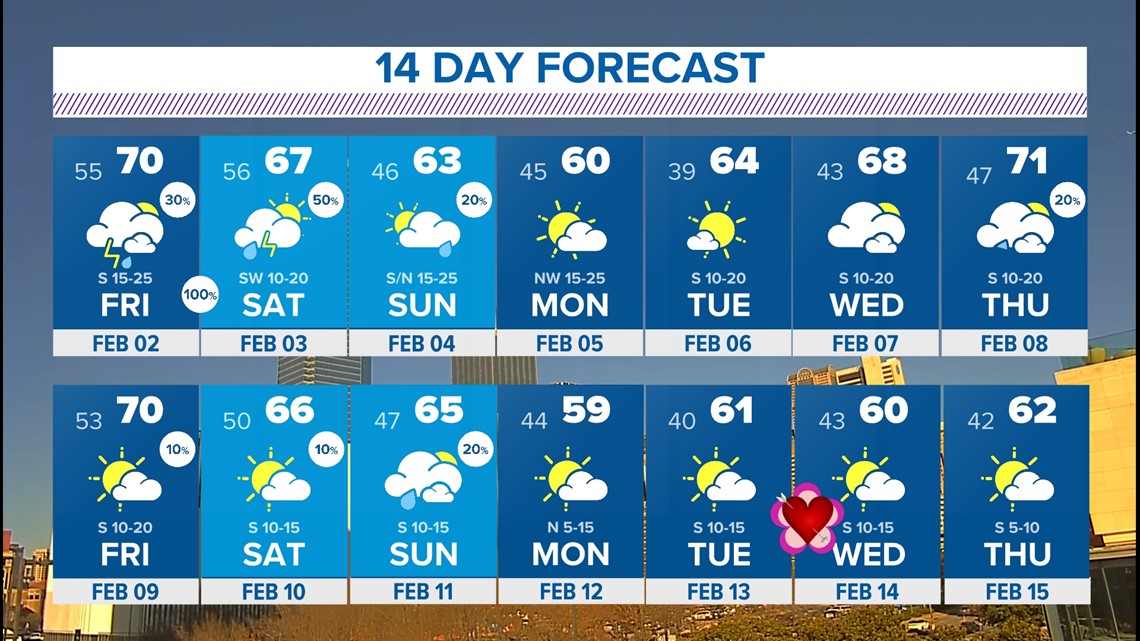
We've seen some of the warmest temps all winter over the last several days with highs well above 70°!
Those 70s and 60s will continue the rest of the week, and NEXT week, too. A nice treat after the cold and below freezing highs earlier in the month! A cold front over the weekend will help temps drop closer to normal for February, but still not all that cold. In fact, still above normal.


Widespread rain returns
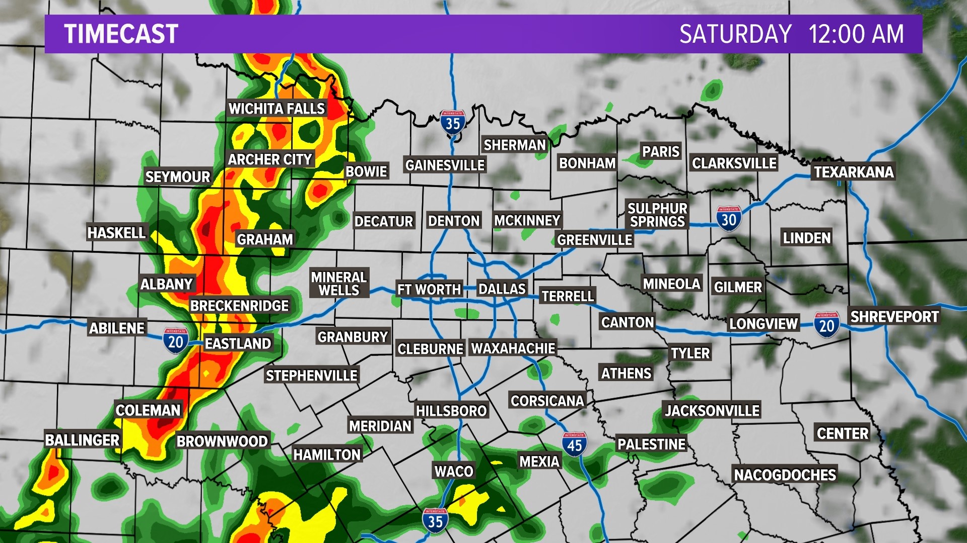
Cloud cover returns even more on Friday ahead of our next system. This one is set to bring another round of widespread rain mostly Friday night into Saturday morning. Some scattered showers and storms will be possible as early as Friday afternoon and evening, but widespread rain looks more likely Friday night into Saturday morning. Some of the rain could be heavy at times.


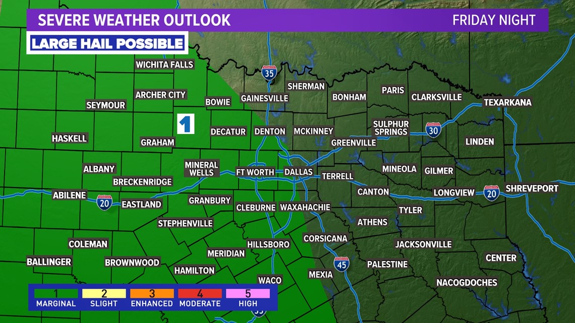
The severe threat looks low as of now, but some thunderstorms will be likely. Hail will be possible with an isolated strong storm or two especially west of the metroplex.


As of now, it looks like most of North Texas (including DFW) could pick up around 1in of rain over the weekend. Widespread flooding issues are not likely, but there could be some localized issues in areas that saw the most rain over the past week (mainly east of DFW).


14 Day Forecast
February can bring wild swings in temps and active weather at times, but the first two weeks of February look fairly tame at this point. Mostly above normal with some rain at times.


