DALLAS — Officially, there is just under one week of summer left and it'll sure feel like it — the autumn equinox happens at 7:43 a.m. on Sunday, Sept. 22, kicking off the official start of fall.
Here's what to expect in North Texas through the rest of the summer:
Quick Notes:
- Hot, dry, and humid through the week
- Rain chances stay slim to none for now
- Possible cool front by next week
Rest of this week and this weekend
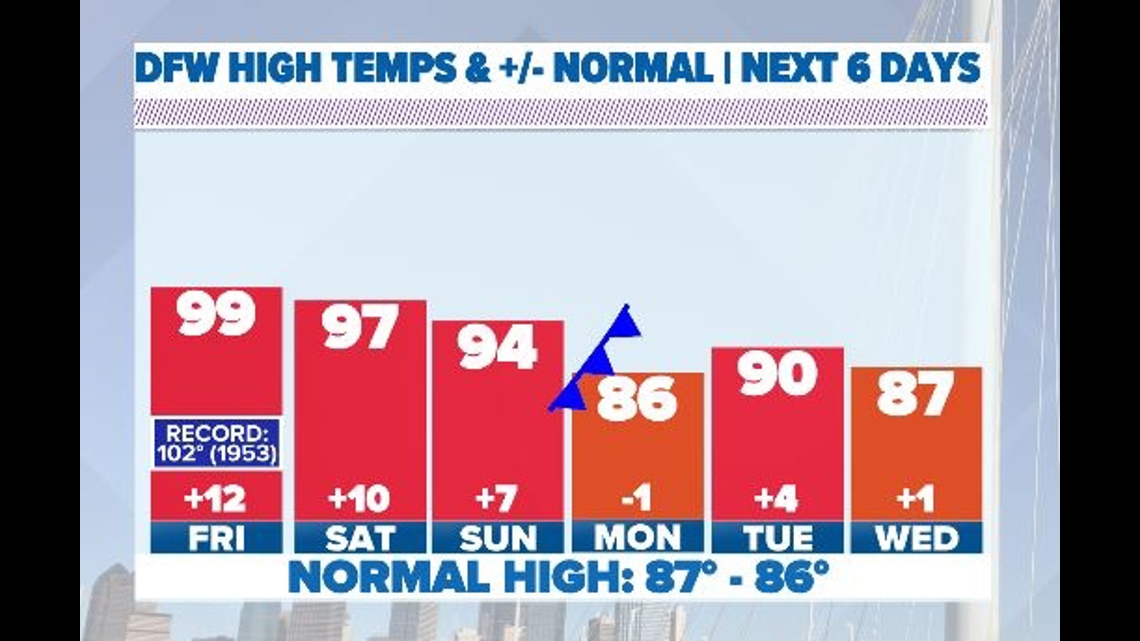
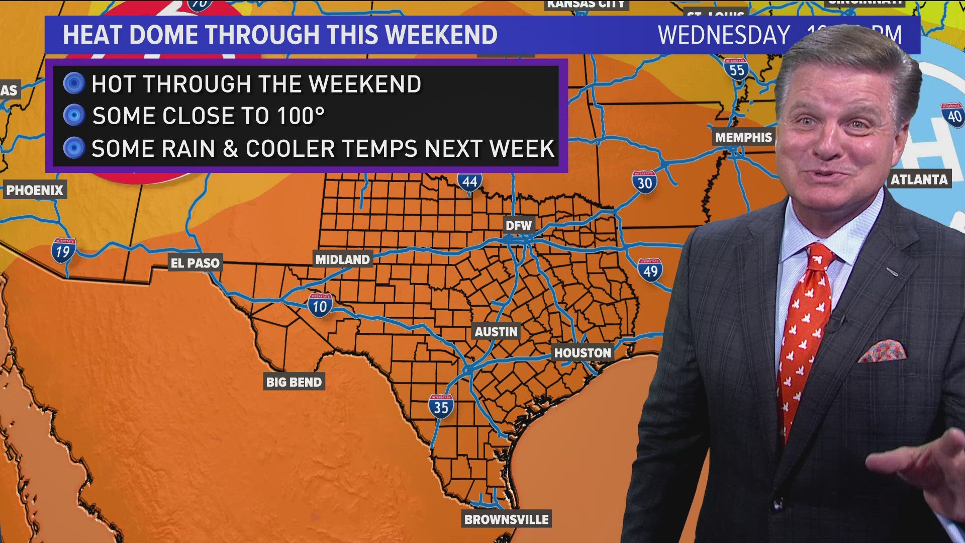
The hottest temps of this current wave of heat will be Friday through Saturday. Highs will be well into the 90s, with heat index values of 100° or higher for most afternoons. While record heat is not likely, these temps are about 10° above normal for this time of year.
It'll be rain-free well into the first part of this weekend. There's an outside chance for a few showers or storms Sunday across western areas but chances are not high.
More clouds would be around on Sunday keeping temps slightly "cooler" and a front next week will hopefully drop temps even more.


Relief next week?
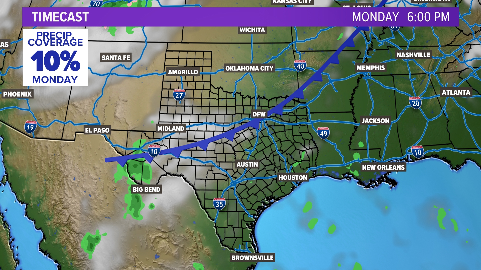
A cold front could bring some relief early next week. Temps will be back closer to normal and rain chances may make a return as well for the first half of the week. Not guaranteed at this point, but that looks to be our next chance if it pans out. The latest trend has temperatures dropping into the 80s. We'll keep an eye on it!
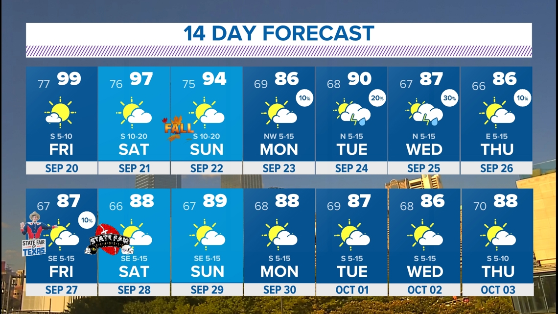
It is not uncommon to see triple digits in September with the latest one on record happening Oct. 3 in 1951. Currently, there are no triple digits in the forecast just above normal temps. October is generally when we see a bit more fall-like weather. The average high temperatures drop from 84° at the beginning of the month to 72° at the end of the month.
14-Day forecast


