DALLAS — We go from winter back to spring in a big way to end the weekend!
Be sure to download the WFAA app for the latest weather and radar updates and alerts.
Here's a rundown of what we're expecting:
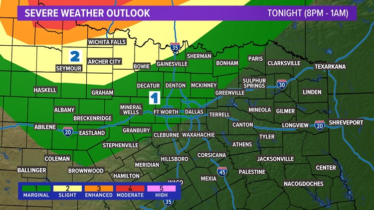
- A round of t-storms is likely tonight. Some storms could be severe for western North Texas
- We are sunny and warm on Monday
Very windy and warmer
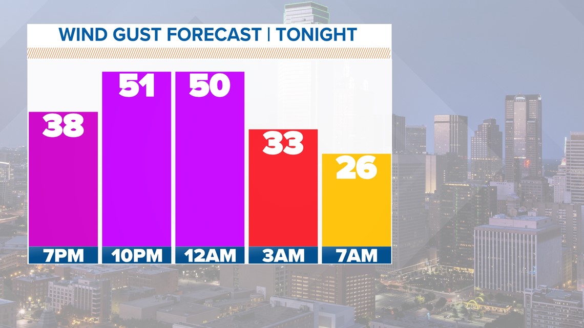
Winds will steadily increase out of the south during the day Sunday becoming very gusty by late afternoon into evening and continuing into the overnight hours.
A Wind Advisory is in effect now until 2 a.m.
Gusts between 40-50mph are possible especially late tonight.

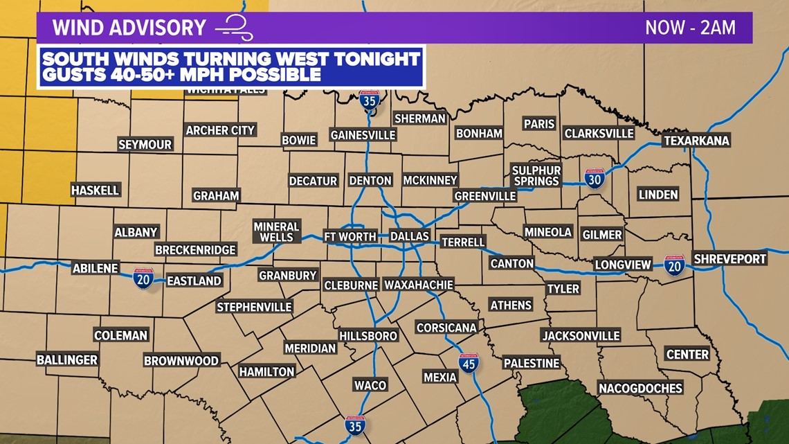
We do have storm chances overnight (read more below) that could have some gusty winds, but winds will be very gusty overnight regardless of t-storms. Gusts of 40-50+ mph are possible overnight.

Return of t-storms
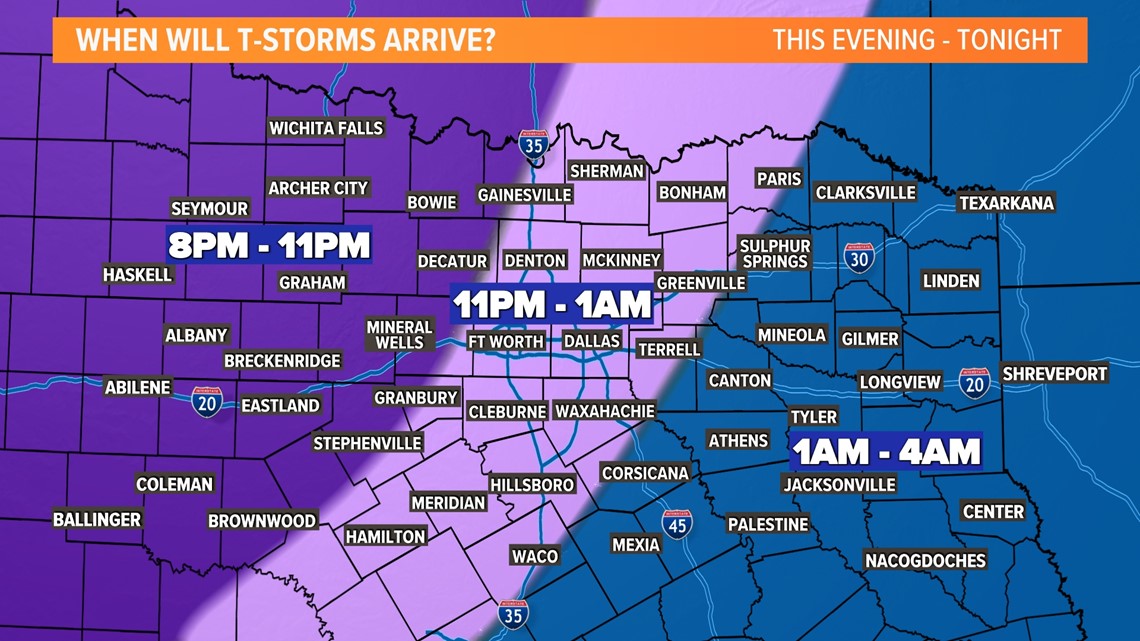
A quick-moving round of t-storms will sweep across North Texas Sunday evening into Sunday night.
For D-FW the timing looks to be around 11 p.m. to 1 a.m.
Western parts of North Texas will see storms prior to then and eastern North Texas will see storms after 1 a.m.

Severe threat
For most of North Texas, the severe threat with this round of storms is low.
As storms move into northwestern North Texas, some could be severe with damaging wind gusts and up to quarter size hail. The tornado threat is low, but not zero for those areas.
As storms move east, they will weaken with a low, but not completely zero severe weather threat for D-FW. Can't rule out some hail and strong winds as the storms move through D-FW.


The next 10 days
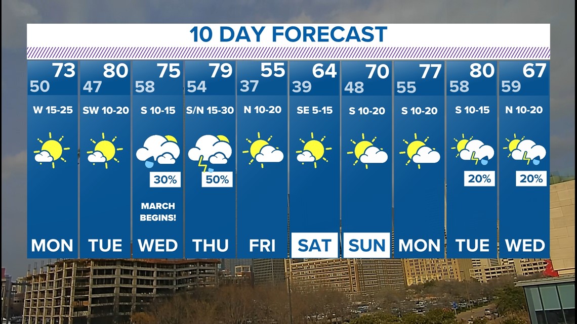
Temps stay warm into the first half of next week with highs in the 70s maybe even hitting 80°.
We cloud up again midweek with a chance for passing showers or storms Wednesday, Thursday, and into Thursday night.
That storm system will bring another cool-down by Friday, but temps warm into the weekend.

