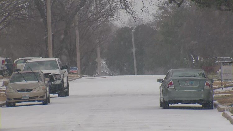
DALLAS — Sleet, snow, ice and freezing temperatures are all in the forecast for North Texas this week. If that gives you anxiety, we get it.
Last year's February freeze cut power to millions of Texans, and the harsh conditions lasted more than a week.
This week's storm is likely to cause traffic problems on icy roads, and downed power lines and outages can't be ruled out. But we can't emphasize this enough: This is NOT expected to be similar to last year's widespread, life-threatening freeze conditions.
"Perspective is key," WFAA meteorologist Jesse Hawila said. "We don't expect anything like we saw last year."
While forecast details are still evolving, here's a look at the numbers we know, for now, and how they compare to what we saw in North Texas and around the state this time last year:
How long did the storm last?
2021: Last year's storm dropped temperatures below freezing for almost all of 10 days straight.
Temperatures dipped below freezing at 5 p.m. on Feb. 9 and stayed below freezing until 2 p.m. on Feb. 13, a total of 93 hours.
The temperature climbed slightly to 33 degrees for about three hours, before dipping back below freezing at 5 p.m. on February 13. Temperatures stayed below freezing for another 139 hours, until noon on Feb. 19.
2022: This year's system is expected to drop temperatures below freezing for about 44 hours, with the possibility of climbing above freezing during the day Thursday. All in all, the system could last up to three days, less than half of what we saw last year.
Temperatures are expected to rise into the high 30s and 40s this weekend.
How much snow and ice?
2021: DFW Airport recorded five inches of snowfall from Feb. 14-17 and around half of an inch of ice fell across the region. Parts of North Texas received up to eight inches of snowfall.
2022: North Texas could receive anywhere from 1-3 inches of snow, though those totals aren't a certainty, yet. Up to about 1/3 of an inch of ice could accumulate in parts of North Texas.
How cold did it get?
2021: Not only did North Texas remain below freezing for nearly 10 days straight, the temperatures dipped well below freezing. The recorded low temperature in last year's storm was two below zero.
2022: This is another key difference between this year and last year. The lowest forecasted temperature this week is 14 degrees.
How many counties were affected?
2021: Last year's storm was a statewide event that resulted in all 254 counties being placed under a winter storm warning. The statewide nature of last year's storm was another reason the Texas power grid was placed under so much stress.
2022: This is not expected to be a widespread event outside of North Texas. Areas near Houston and into South Texas could see the potential for freezing rain but no widespread impacts are expected.
How did it affect the power grid?
2021: Last year's statewide storm pushed the Texas power grid to the brink of collapse, and rolling blackouts left millions without power. The devastating conditions killed at least 246 Texans. And if the grid remained operational for the whole storm, officials estimated the power demand would have hit 77 gigawatts. Texas previously had never exceeded 67 gigawatts.
2022: While this year's storm won't be statewide, Texas energy officials are anticipating that Friday morning will be the highest power demand since last year's storm, with an estimated 73 gigawatts being projected.
Still, ERCOT's interim CEO, Brad Jones, is confident the grid will pass its first major test since new winterization protocols were put into place.
“We are very ready. We have spent the last 12 months making sure that all of the generators are ready to operate,” Jones said on Friday. “They’ve improved their weatherization, made sure they have more insulation on their equipment, and we’ve gone out and inspected them to make sure they’ve done that.”


