DALLAS —
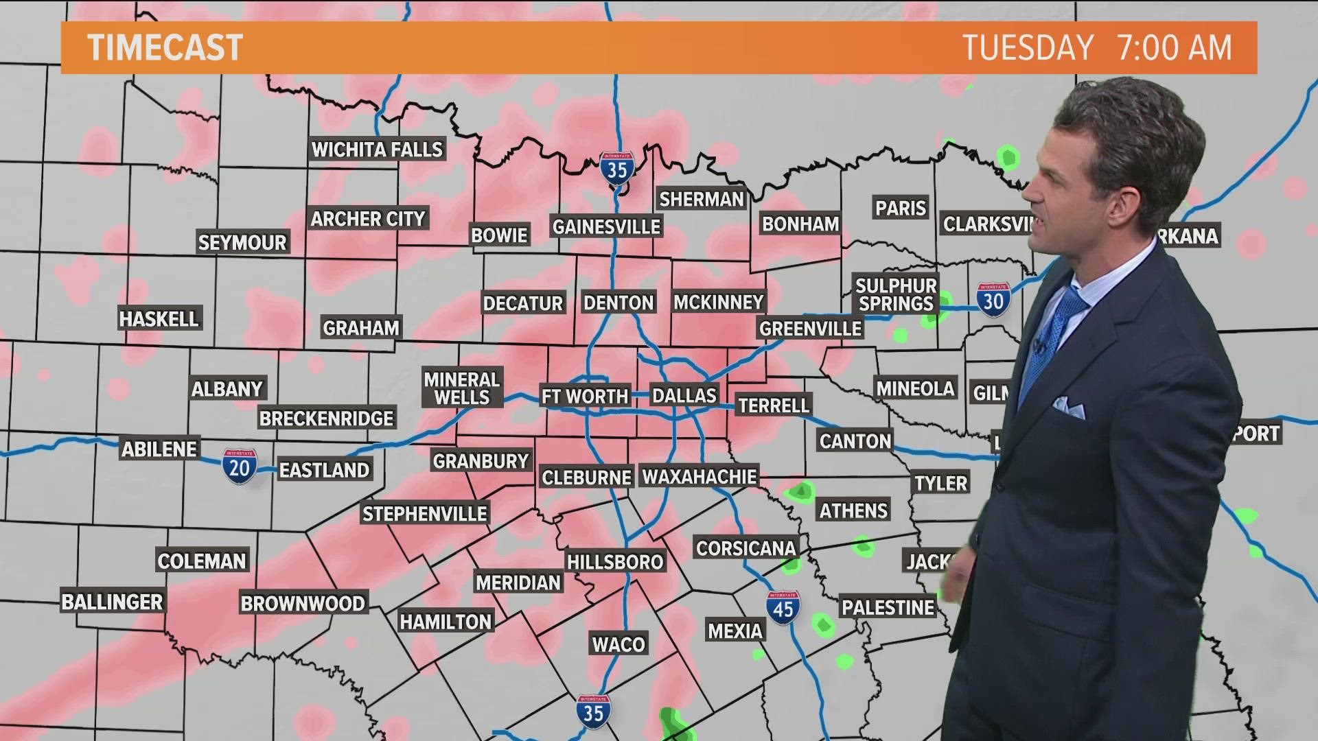
After snow in parts of the region on Tuesday, more wintry weather is headed to North Texas, but this looks to be more icy than snowy.
Here's what you need to know to be best prepared ahead of Monday:
Fast facts:
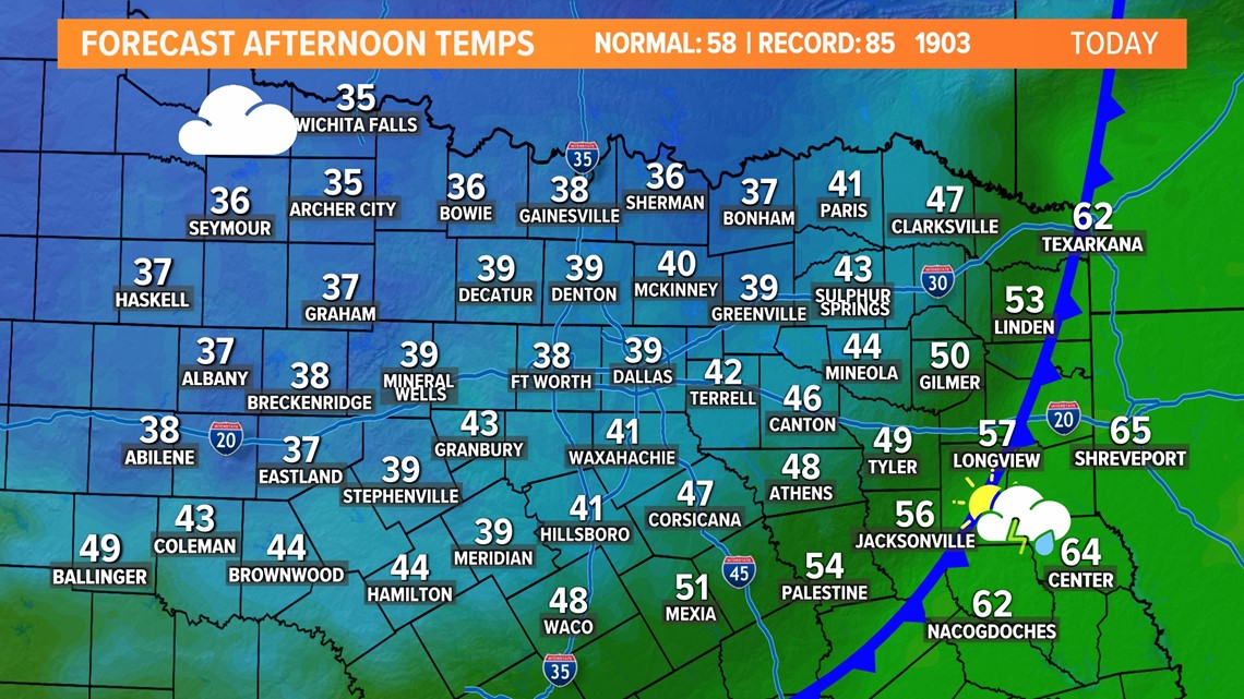
- Sunday will feature falling temps behind an arctic cold front with the afternoon in the 30s and 40s
- Freezing drizzle and freezing rain will be possible for D-FW and the majority of North Texas Monday through Wednesday morning
- Impacts to roads and travel are possible during that time
- A glaze of ice is possible on Monday with perhaps higher totals on Tuesday
- Ice chances will all depend on temps and where and when temps are at or below freezing. Keep checking back for updates as the forecast will continue to be adjusted!
Sunday
Sunday brings changes as a cold front moves through North Texas. Temps will fall throughout the day with afternoon temps in the 30s and 40s. With a breezy wind out of the north, it will feel even cooler. There also could be some spotty to scattered showers or storms from D-FW to the south during the day but it will ont be a washout.

Freezing rain and freezing drizzle
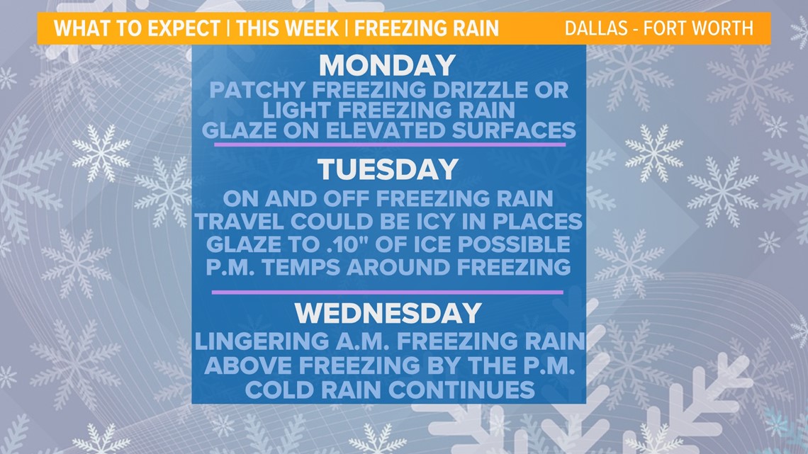
Rounds of freezing rain and freezing drizzle are likely in North Texas Monday through Wednesday.
While it may not rain constantly during that time, with temps at or below freezing, any rain or drizzle that does fall could turn into icy.
Icy conditions on bridges, overpasses, and roads will be possible in places and at times this week.
Monday will feature the potential for a light glaze of ice on elevated surfaces.
Tuesday could be a better chance for widespread icy conditions and higher impacts to travel.

Monday

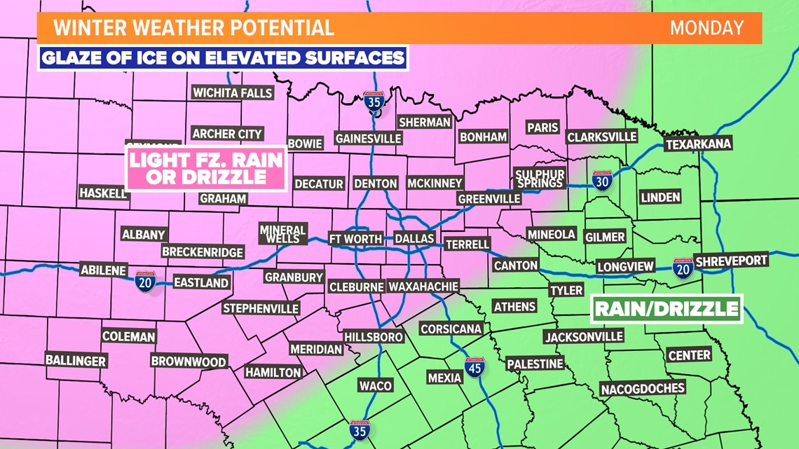
On and off freezing drizzle or light freezing rain is possible during the day. While anything falling from the sky does not look overly heavy, it will be enough to cause a glaze of ice on elevated surfaces. Bridges and overpasses could be slick in places around D-FW to the north and west.
Monday night - Tuesday

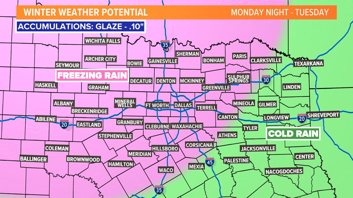
Looks like the best chance to see higher amounts of freezing rain will be late Monday night and through the day on Tuesday. Totals of .10in to perhaps even .25in look possible in some areas.
With temps staying below freezing most of the day, icy roads, bridges, and overpasses are possible. Travel could be tricky in places on Tuesday.
Tuesday night - Wednesday morning

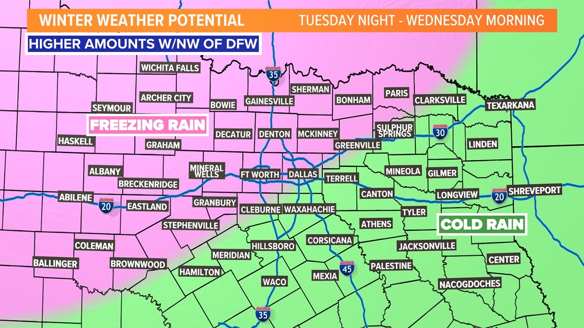
Lingering freezing rain or drizzle will be possible from D-FW to the west.
Exactly how widespread rain will be or how heavy is a bit uncertain right now. But with temps staying around or below freezing, icy conditions will continue to be possible.
Wednesday afternoon - night

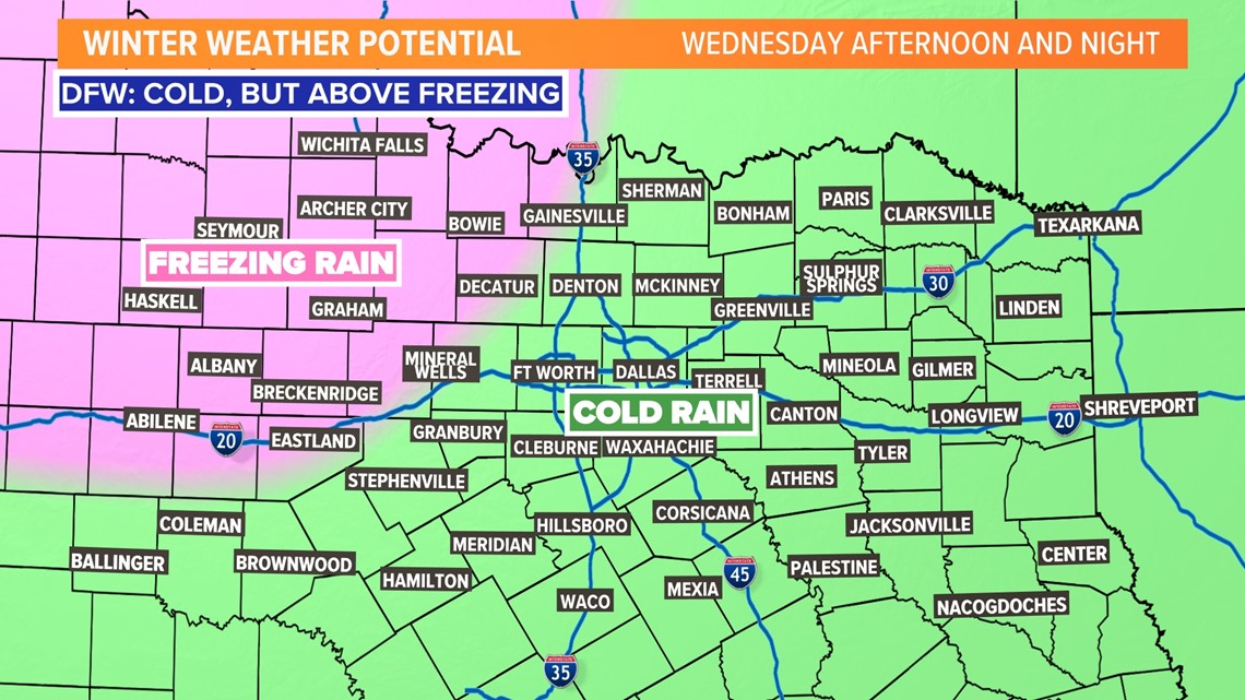
It will stay cold on Wednesday, but temps will warm above freezing for D-FW, so anything falling from the sky should be rain at that point.
However, below freezing and icy conditions may continue across western North Texas.
This is important!
This is very complicated and active forecast. What you see will all depend on the temperature. Also the intensity of precipitation in any area will play a role in how much ice you see.
Just stay on your toes this week and we'll continue to update you with the latest!

