TEXAS, USA —
Today
Showers and isolated storms are possible this morning, mainly along and just south of the Red River. A higher coverage is expected this afternoon northeast of the Metroplex.

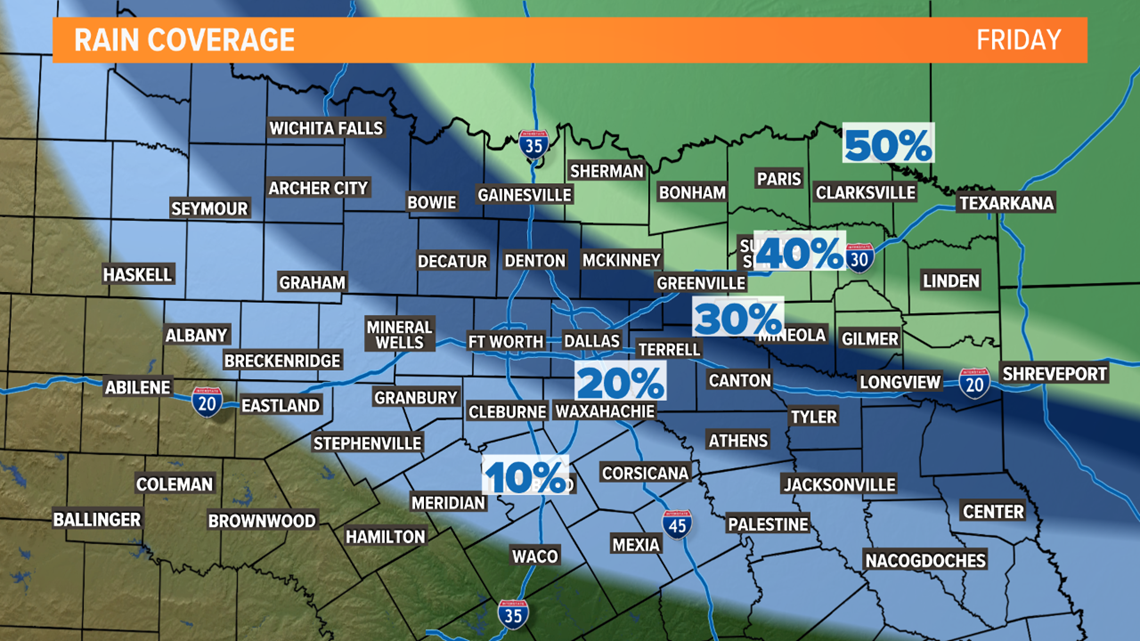
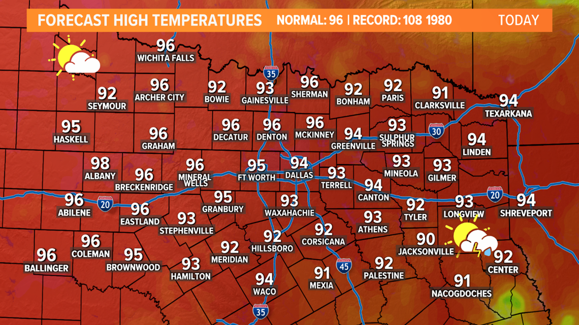
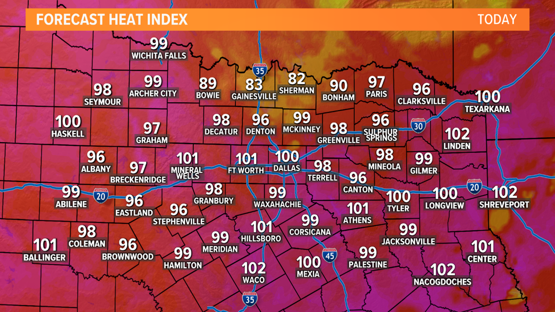
Temperatures also begin to heat up and it will be a bit humid too. Here are the forecast highs and Heat Index for Friday:


We will continue to have low rain chances now moving forward through the weekend. The rain won't amount to much, but a cool drink of water for our plants is nice no matter what.
The Weekend
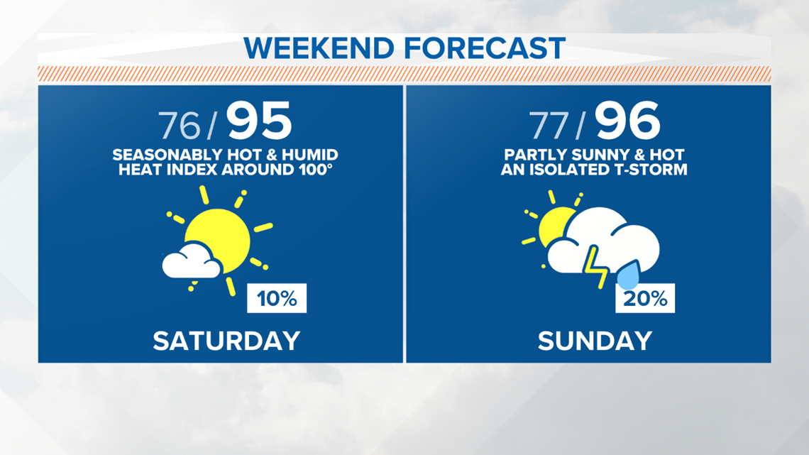
The weekend will be steamy and not a washout by any means. But there will be some low end storm chances mainly on Sunday.

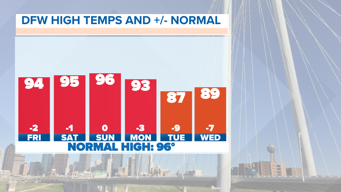
If you look at the beginning of next week our luck hasn't run out quite yet. Temperatures will go back down to the upper 80s and lower 90s for most of next week.

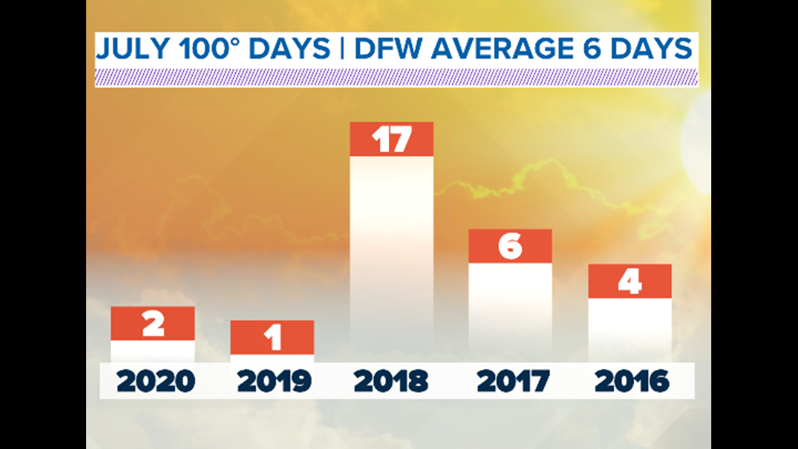
These great temperatures will continue into the second to last weekend of July. Not only have we avoided a typical July set up, but we have not had a single 100 degree day this month when we average about 6 days per month. The last few years have been good to us here in North Texas. We have only had one or two 100 degree days in the month of July. Now 2018 on the other hand...

Active Weather Pattern
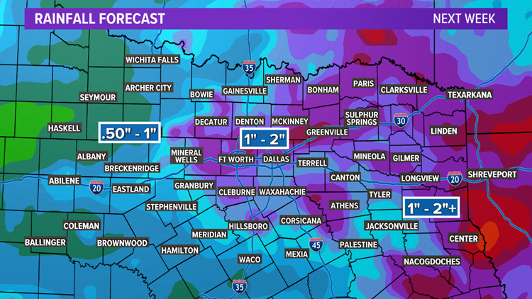
These cooler temperatures will coincide with daily rain chances for the next 10 days. Some days will have higher coverage than others. A weak cold front will slide south into North Texas by Monday and this will provide the environment for more numerous showers and storms. Will everyone see rain? No, but whoever does see the rain could see a good amount of rainfall through the middle of next week.


Rainfall forecast for next week could bring a half inch to an inch of rain for the Dallas/Fort Worth area with higher totals along the Red River. Any measurable rain is welcomed in the summer and July has been a dream.
Remember to download the WFAA app to check one of our dozens of local radars near you as well as the latest forecast, cameras and current conditions.


