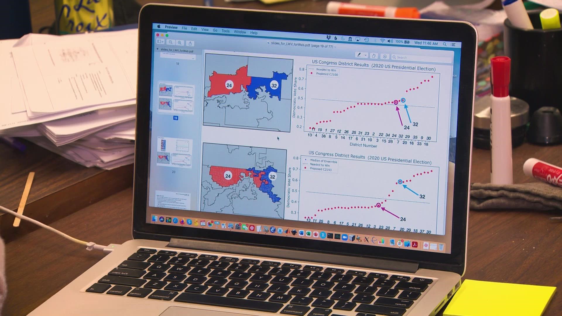
DALLAS — Researchers at Southern Methodist University say new congressional maps passed by Texas lawmakers are significantly biased and engineered to create a Republican advantage.
Andrea Barreiro is an associate professor of mathematics at SMU and part of the group Math for Unbiased Maps. She says the group produced 1.5 million random maps based on rules for redistricting like similar populations and keeping districts contiguous.
The legislature’s passed map, though, was far beyond even the most extremely biased map from the 1.5 million.
“We were actually kind of shocked and we felt a little angry I think,” Barreiro said. “It was very clearly biased.”
Math for Unbiased Maps started last spring to study redistricting using what’s known as Markov Chain Monte Carlo (MCMC) method for guiding a random search. The goal was to see how much the maps were gerrymandered, where they’re purposefully set to give one party an advantage.
“We wanted fair maps as voters and as citizens,” she said.
Redistricting only happens every 10 years when new census data is released. This year, Texas added two congressional seats and Barreiro says there are likely billions of ways to carve up the state even bound by legal map-making guidelines.
Census data shows 95% of Texas’ growth is communities of color that vote Democratic. That includes 1.9 million new Hispanic residents, nearly 10 times the number of non-Hispanic white residents added to the state.
“It will determine the shape of power for the whole of the decade,” Michael Li, senior counsel at NYU’s Brennan Center, told WFAA last fall. “It is something that is challenging, but I like to call redistricting an every-10-year Olympics.”
Li said Texas has been flagged before and faced legal challenges over intentional discrimination.
They tested both the new state senate district map and congressional districts. The 1.5 million maps created gave them a baseline to work from.
The median model would give Democrats a two-district advantage, but the maps approved instead gave Republicans a 12-district edge.
“Excessive political gerrymandering harms the voter,” Barreiro said. “it makes races less competitive. It privileges one political party over another. It can privilege one racial group over another.”
It’s done in one of two ways. Either districts are packed together where all voters of one party are put in the same district, so their voters have less impacts or they’re ‘cracked’ meaning they're diluted with so many voters from the other party that their votes matter less. Barreiro says Texas in North Texas, Beth Van Duyne’s district became redder and Collin Allred’s became bluer, meaning primaries matter more than election days.
“Essentially the outcome is predetermined almost before you show up at the polling booth in November,” she said. “These districts swirl around each other like a cinnamon roll, like what is the logic in that.”
The group also reviewed the new Dallas City Council map. The city is sharply Democrat-leaning making the partisan divide not an issue, but some options had chopped up different demographic segments before a final map fixed the issue according to Math for Unbiased Maps.
Better technology is making the problem worse than a decade ago.
“The problem worsened from 2010 to 2020 and even if you look at the maps, you’ll see they’re drawn at a much finer scale,” Barreiro said. “It harms voters on both sides, and we can demonstrate that that was happening at the Texas legislature this year.”

