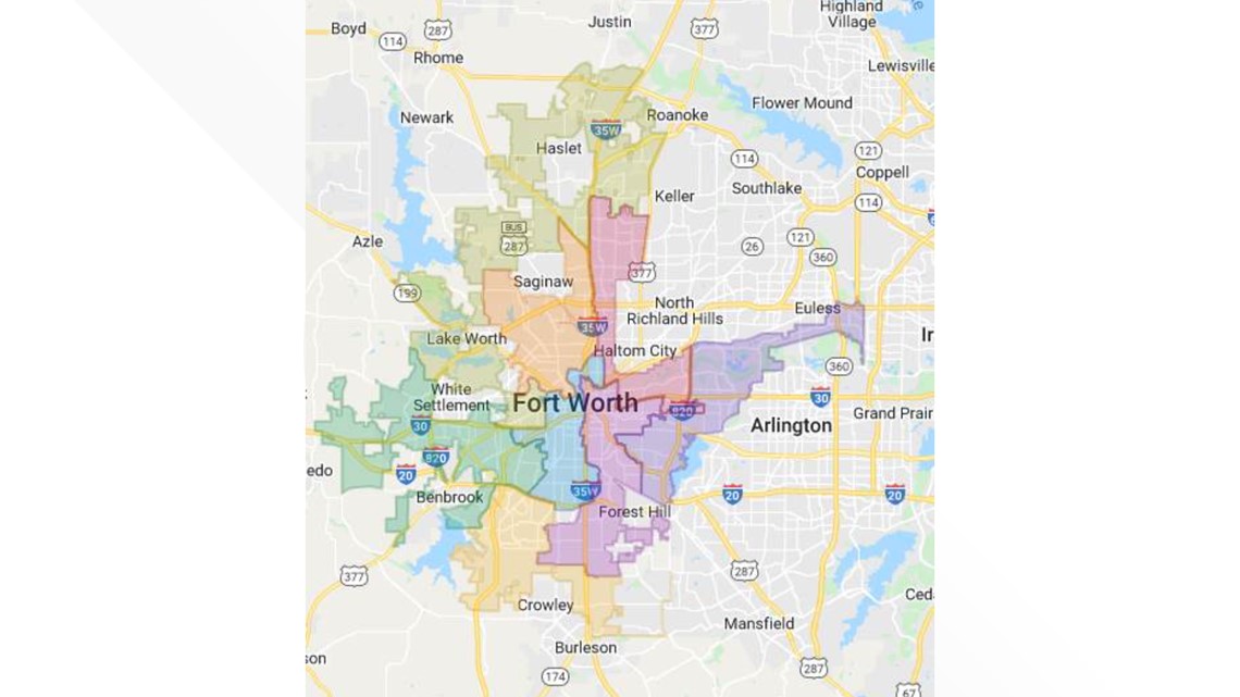
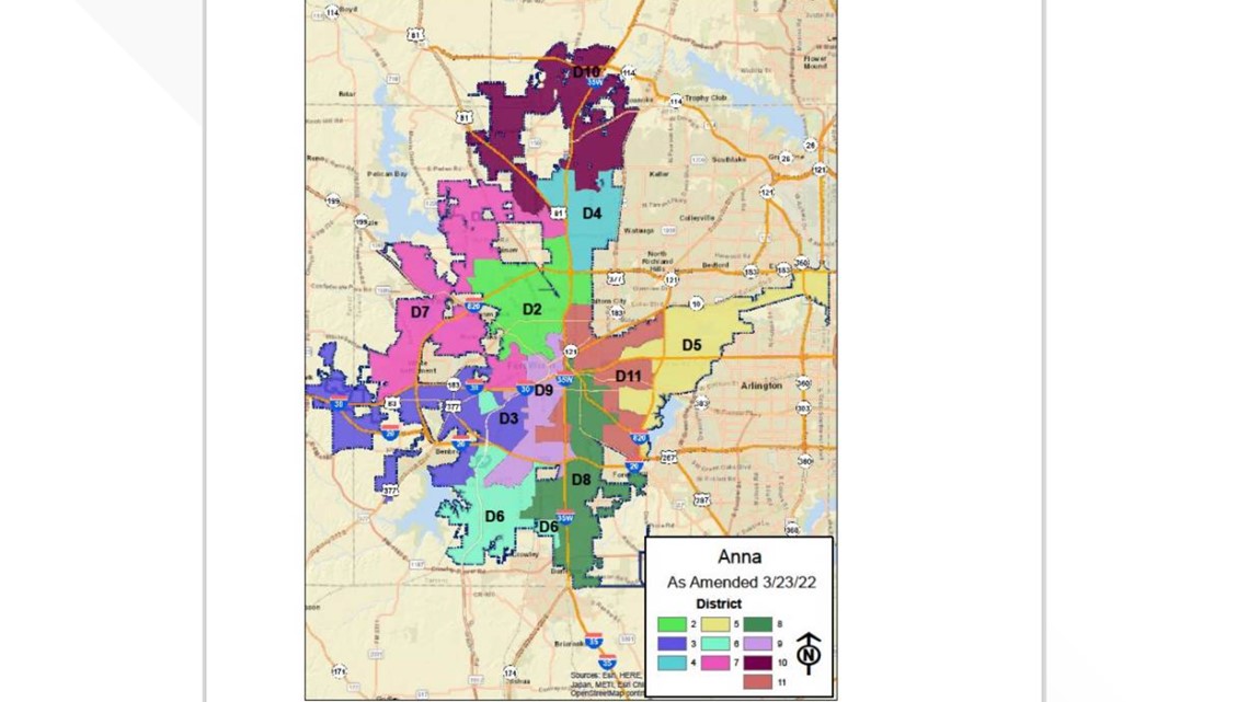
FORT WORTH, Texas — Fort Worth City Council unanimously approved Tuesday its new district map outlining the boundaries of where each council member represents.
In 2016, Fort Worth voters approved an amendment to the city charter to increase the number of city council members from nine to 11 following the completion of the 2020 Census.
The Task Force on Race and Culture in December 2018 recommended the goal of ensuring that the city council reflects the diverse communities that it represents.
In August 2020, councilmembers appointed a Redistricting Task Force and charged them with “evaluating the criteria and procedures by which the City Council has redrawn council district boundaries in the past and, accordingly, advising the City Council about redistricting criteria and procedures that the City Council should use in the future.”
Here is a breakdown of the members of the task force created:
August 2020 – March 2021
- Place 1 Lorraine Miller (Chair)
- Place 2 Salvador Espino
- Place 3 Graham Norris
- Place 4 Craig Allen
- Place 5 Bert Williams
- Place 6 Linda Kennedy
- Place 7 Tony DeVito
- Place 8 Tracy Scott
- Place 9 Kent Bradshaw
- Place 10 Bill Schur
- Place 11 Teresa Ayala
In October 2021, the task force was once again asked to assist in the redistricting process by serving as the group that would evaluate maps and select a map for public comment and review. Some task force members were no longer able to serve, so new members were appointed.
October 2021 – January 2022 (bolded members previously served)
- Place 1 Bill Schur
- Place 2 Salvador Espino (Chair)
- Place 3 Graham Norris
- Place 4 Janna Herrera
- Place 5 Bert Williams (Vice Chair)
- Place 6 Linda Kennedy
- Place 7 Tony DeVito
- Place 8 Lucretia Powell
- Place 9 Kent Bradshaw
- Place 10 Ossana Hermosillo
- Place 11 Dr. Whitnee Boyd
In March 2021, the redistricting task force presented 10 criteria for redistricting.
The following criteria were considered "high priority":
- Approximately equal size: Population of largest district less than or equal to 10% more than population of smallest district.
- Compliance with the U.S. Constitution, Voting Rights Act, Texas Constitution and other applicable laws, with no packing or minority voters, no fragmentation of minority communities and no retrogression in ability of minorities to participate in electoral process.
- Create minority opportunity districts, in compliance with federal law, to reflect growing diversity of city. Such districts – in which African Americans, Hispanics and other minorities collectively represent 50% or more of the voting-age population – are intended to create opportunities for fair representation rather than to promote electoral outcomes. Electability is a function of many factors, including candidate qualifications appeal to voters, voting-age population, voter registration and voter participation as well as demographics characteristics.
- Contain communities of interest in single districts, with community of interest defined as “a local population with shared socio-economic characteristics and political institutions that would benefit from unified representation.” Communities of interest may include neighborhoods, groups of neighborhoods, school attendance zones and similar geographic areas.
- Contiguous territory.
These criteria were considered "low priority":
- Compact districts, with goal of Polsby-Popper ration greater or equal to 0.050. If any proposed district yields a compactness score that is less than 0.050, then a detailed justification must be stated.
- Identifiable geographic boundaries, such as streams, railroad tracks and highways. To the extent possible, dwelling units that are located on opposite sides of the same residential street shall be assigned to the same district.
- Contain while voting precincts.
- Contain while census blocks or block groups.
- Do not consider place of residence of incumbents or potential candidates.
The group urged transparency in the redistricting process by requiring all map drawings to occur at public meetings, with computer screens visible to all parties. The City posted all of the considered maps submitted prior to the Nov. 12 deadline online here. Staff also provided an evaluation for each map to identify criteria that was met.
Here is a look at the Fort Worth districts before and after the approved change:
Before


After


