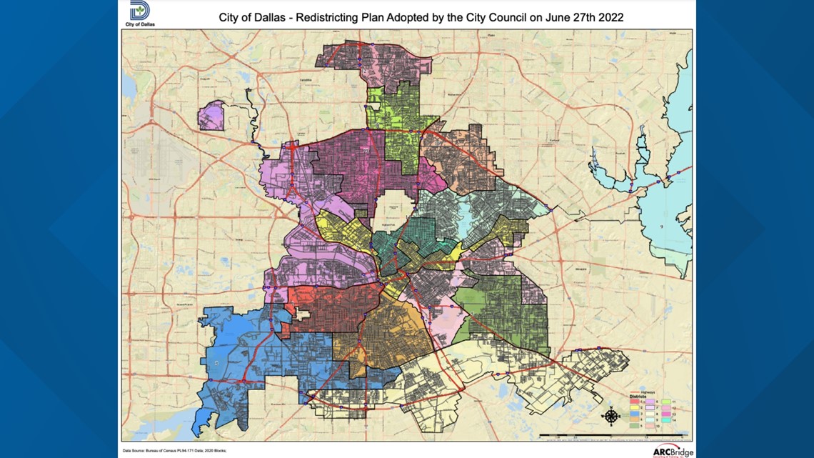
DALLAS — The Dallas City Council has approved a new district map, which will go into effect for next May's municipal election, officials said Monday.
The council approved and adopted the redistricting plan that was submitted by the city's redistricting commission on May 16.
The council had 45 days to approve or modify the plan.
The new district map contains few changes to the existing layout.
The changes include extending the downtown District 2 more to the northeast, into parts of District 9 and District 7, and more to the northwest, into parts of District 6 along Interstate 35E.
Other changes include slight expansions of districts: District 1 grows slightly to the southwest, into District 3; District 5 expands slightly to the north and southwest into District 7; and District 11 expands slightly north, into District 12, while District 12 expands to the south, into the west side of District 11.
Read the full redistricting plan and view the full map here:


While District 2's land area expands under the new map, the district loses about 4,900 residents, the biggest drop on the new map.
District 9 in northeast Dallas grew by about 4,700 residents, and District 14 in Uptown and Old East Dallas grew by about 1,400 residents.
“Redistricting is critical to a functioning representative democracy. I am grateful for the work of our Redistricting Commission, skillfully and fairly led by Chairman Jesse Oliver, and I am pleased that the Dallas City Council was able to coalesce around further modifications to the new map,” Dallas Mayor Eric Johnson said in a city news release. “I would also like to thank all of our residents who participated in the process by submitting a map, providing feedback, or attending a public meeting. Public engagement is critical to building a stronger city."


