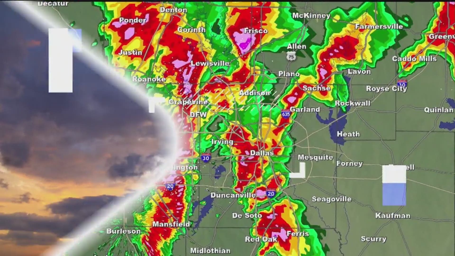
REST OF TODAY
Cloud cover is much more abundant today which will help hold temps down. Highs today will only be in the 80s in most locations. However, if you see some sunshine, temps may jump into the upper 80s to 90°.
That cloud cover also looks like it will keep pop-up showers and storms from being as numerous this afternoon. Not impossible by any means, but less numerous. Coverage this afternoon is looking lower than yesterday. Best chances for storms this afternoon look to be in areas that warm up the most, and did not see rain this morning.
If you have outdoor plans, once again keep an eye on the sky and if you see lightning or hear thunder, head indoors!
8 a.m. Update:
Light rain will linger for another couple of hours before most activity comes to an end by midday.
Redevelopment of showers and storms is possible this afternoon and this evening, but coverage does not look as high as yesterday. Cloud cover and morning rain will help not as many storms form later today. Highest coverage looks to be in areas that don't see rain this morning.
7:15 a.m. Update:
6:35 a.m. Update:
Rain continues to weaken and fall apart, but is still out there. Not everyone will see rain this morning, but some locations will. Best chances for the DFW area will be across the western half of The Metroplex.
6 a.m. Update:
5:45 a.m. Sunday Update:
Heaviest t-storms are moving through southwestern North Texas (Glen Rose to Stephenville to Hamilton). They are NOT severe, but gusty winds of 30-35mph are possible. Elsewhere, light to moderate rain continues across western North Texas slowly moving east. This rain will likely move into parts of the DFW area over the next several hours. Check the radar before you head out the door this morning!
Rain will come to a close through the remainder of the morning with most activity done by midday. Then we will be watching for pop-up showers and storms this afternoon. However, I do not believe coverage will be widespread as yesterday, and best chances will likely be in areas that do not see rain this morning. Mainly eastern and southeastern North Texas.
Updated at 10:30 p.m.
Welcome to June! More rain is on the way next week. June is normally our third rainiest month, so this isn't anything out of the ordinary. Keep an eye on the sky if you have any outdoor plans.
Another round of storms will move in on Sunday morning. It will lose some of its steam as it enters the heart of North Texas. Some gusty winds and pockets of heavy rain are possible, mainly around 9 a.m. for the northwest parts of the metroplex.
A few more pop-up storms are expected mainly east of DFW from 4 p.m. to 6 p.m.
Check the WFAA radars for the latest weather where you are. Be sure to also download the WFAA app for the latest updates.
Hurricane season just began Saturday, and we already have something worth monitoring in the Gulf of Mexico. This has about a 60% chance of developing into a tropical system within 48 hours. Parts of the Texas coast could see some rain out of this early next week.
Widespread showers and storms are possible midweek by Wednesday and Thursday. It's not drought season yet!
Update at 8:45 p.m.
Heavy rain, gusty winds and small hail will be possible over the next couple of hours as storms continue to pulse in North Texas Saturday evening.
As of 7:15 p.m., all storms are now below severe limits.
A Flash Flood Warning has been issued until 8:45 p.m. for Dallas, Cooke, Denton counties.
High water has been reported in areas of Fort Worth and Dallas. Do not drive through flooded roads. Find an alternative route. Turn around, and don't drown!
According to the Fort Worth Office of Emergency Management, crews are responding to 22 calls of high water on the roads. They have closed the 500 block of East Vickery Boulevard and the 300 block of East Morningside Drive.
People had to seek shelter during the annual of Taste Addison as storms move into North Dallas. Tables and chairs went everywhere when the storm hit. The outdoor, three-day event at Addison Circle features outdoor music, food and games for the family.
Some people took to social media and posted pictures of hail and storms seen in their area.


